Dev Blog #68
Hello, everyone!
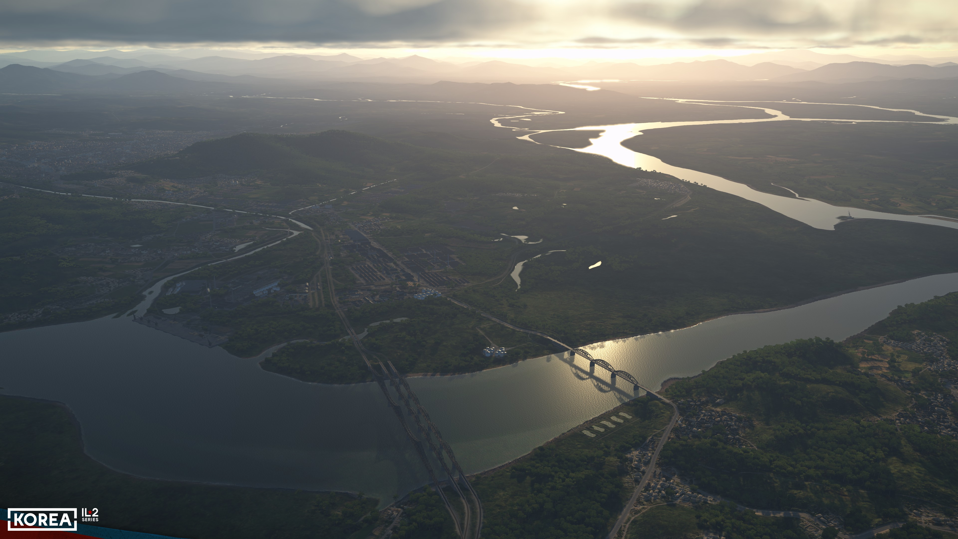
In this issue, we continue our discussion of the map of Korea: not only is the map enormous, the largest in the series, but it’s also more detailed and meticulously crafted than ever before, so there’s plenty to talk about. You can read about why the map and its surroundings are so important and why we pay so much attention to them in our previous Dev Blog #67. Today’s topic is industrial and military facilities.
In this issue, we continue our discussion of the map of Korea: not only is the map enormous, the largest in the series, but it’s also more detailed and meticulously crafted than ever before, so there’s plenty to talk about. You can read about why the map and its surroundings are so important and why we pay so much attention to them in our previous Dev Blog #67. Today’s topic is industrial and military facilities.
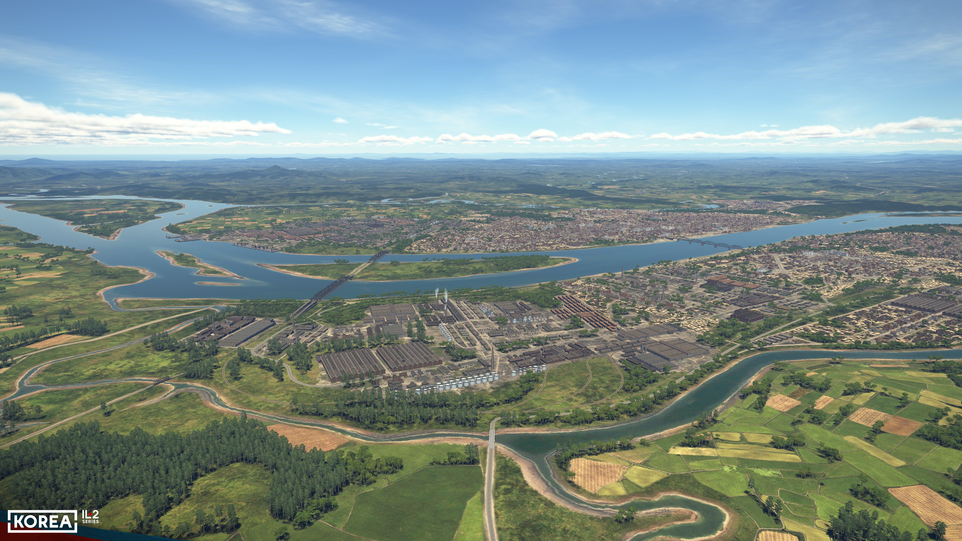
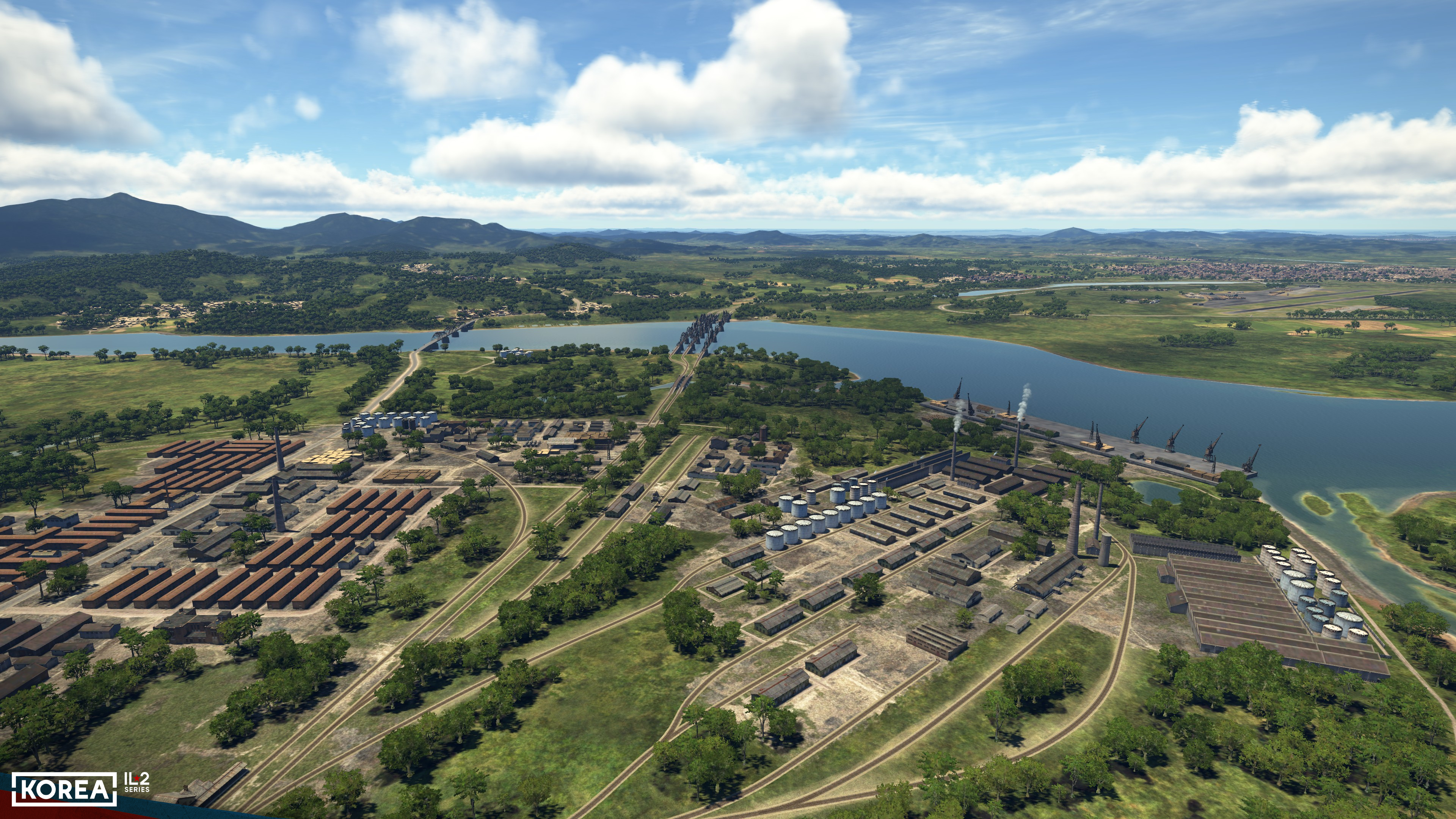
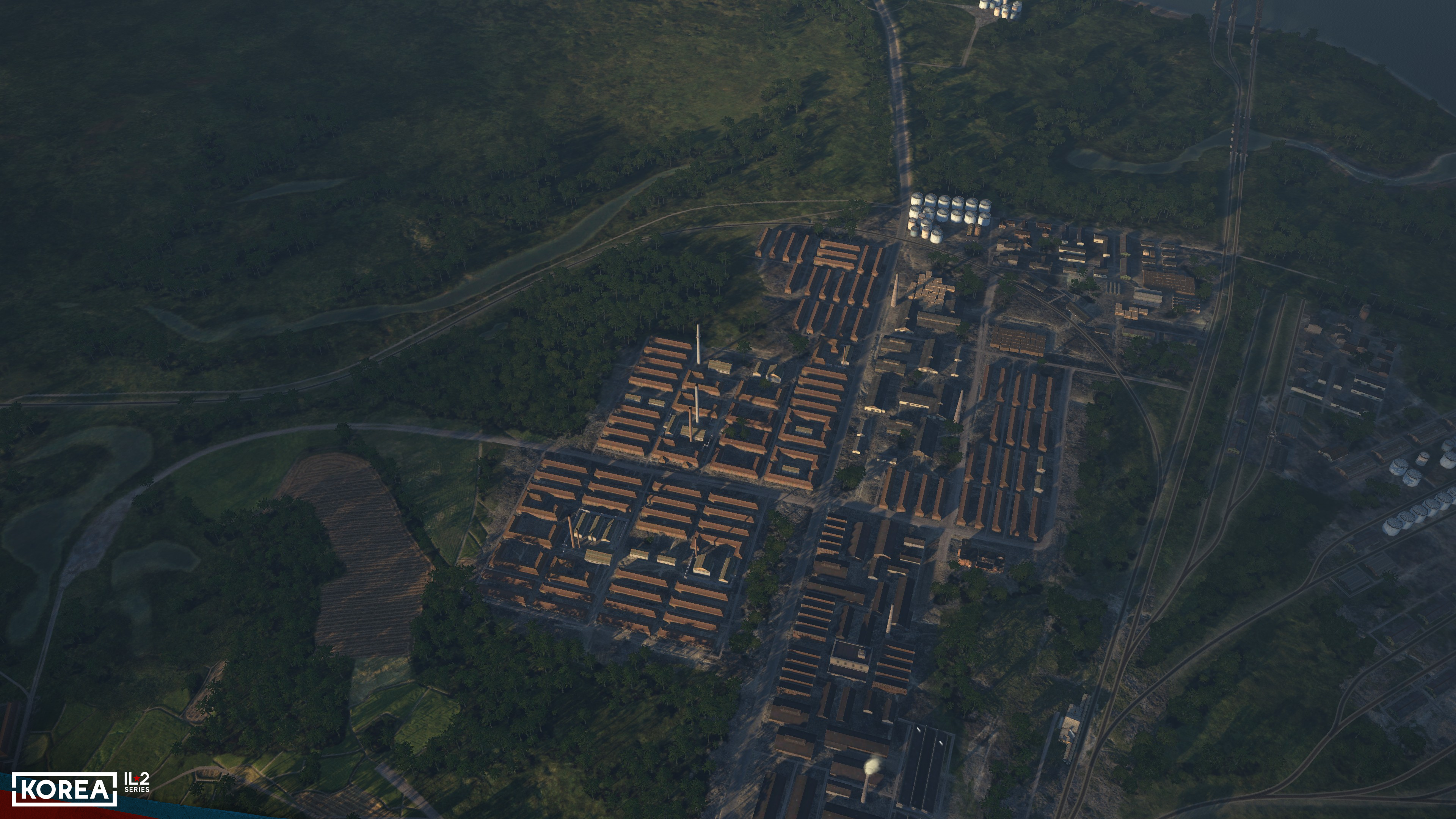
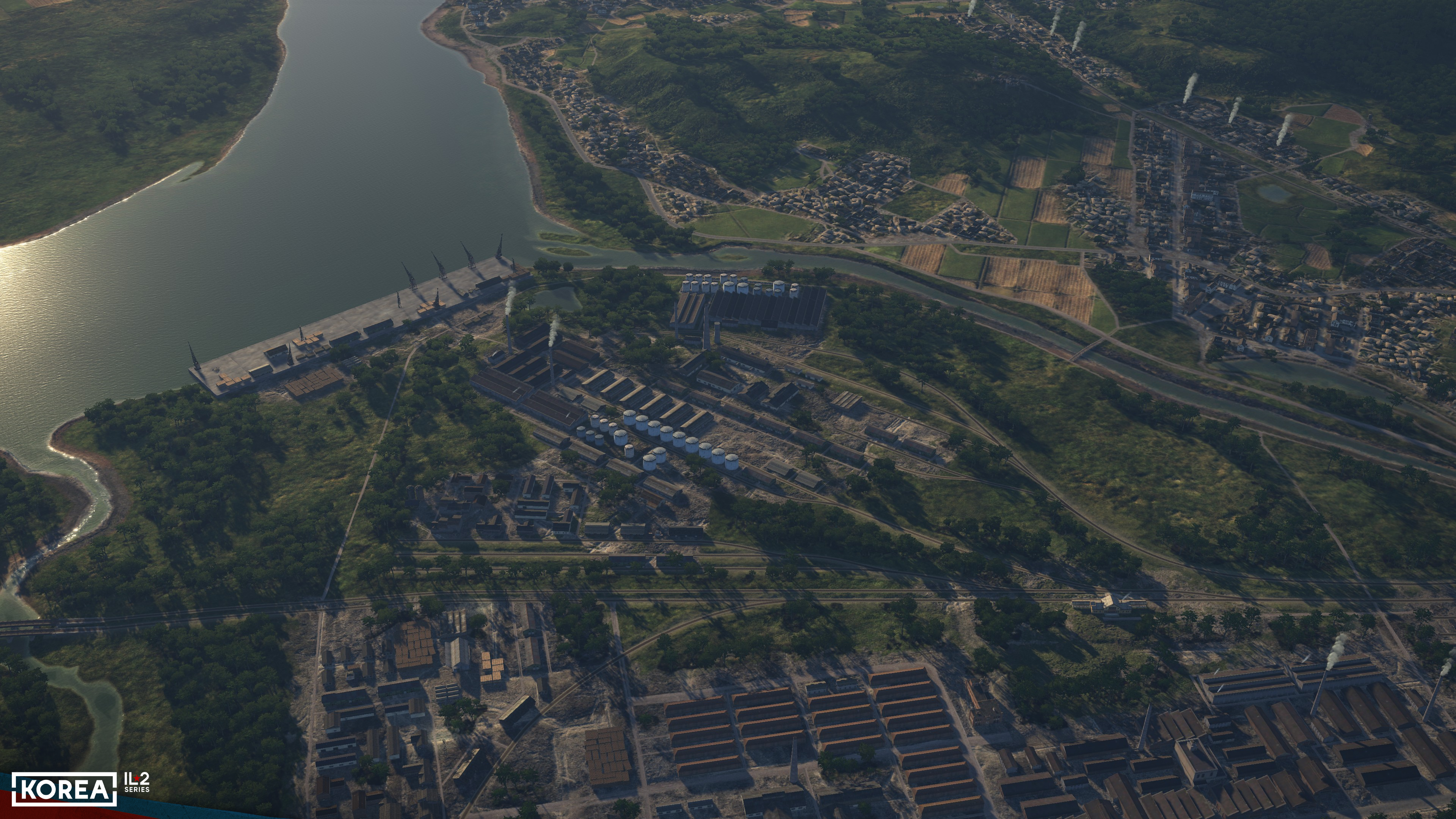
Let’s start with the obvious — and with what has always been reproduced in one form or another before — industrial zones and factories. In "Korea," we’ve developed a new approach to designing these kinds of zones: a special set of underlying surface textures, seamlessly integrated into the surrounding landscape.
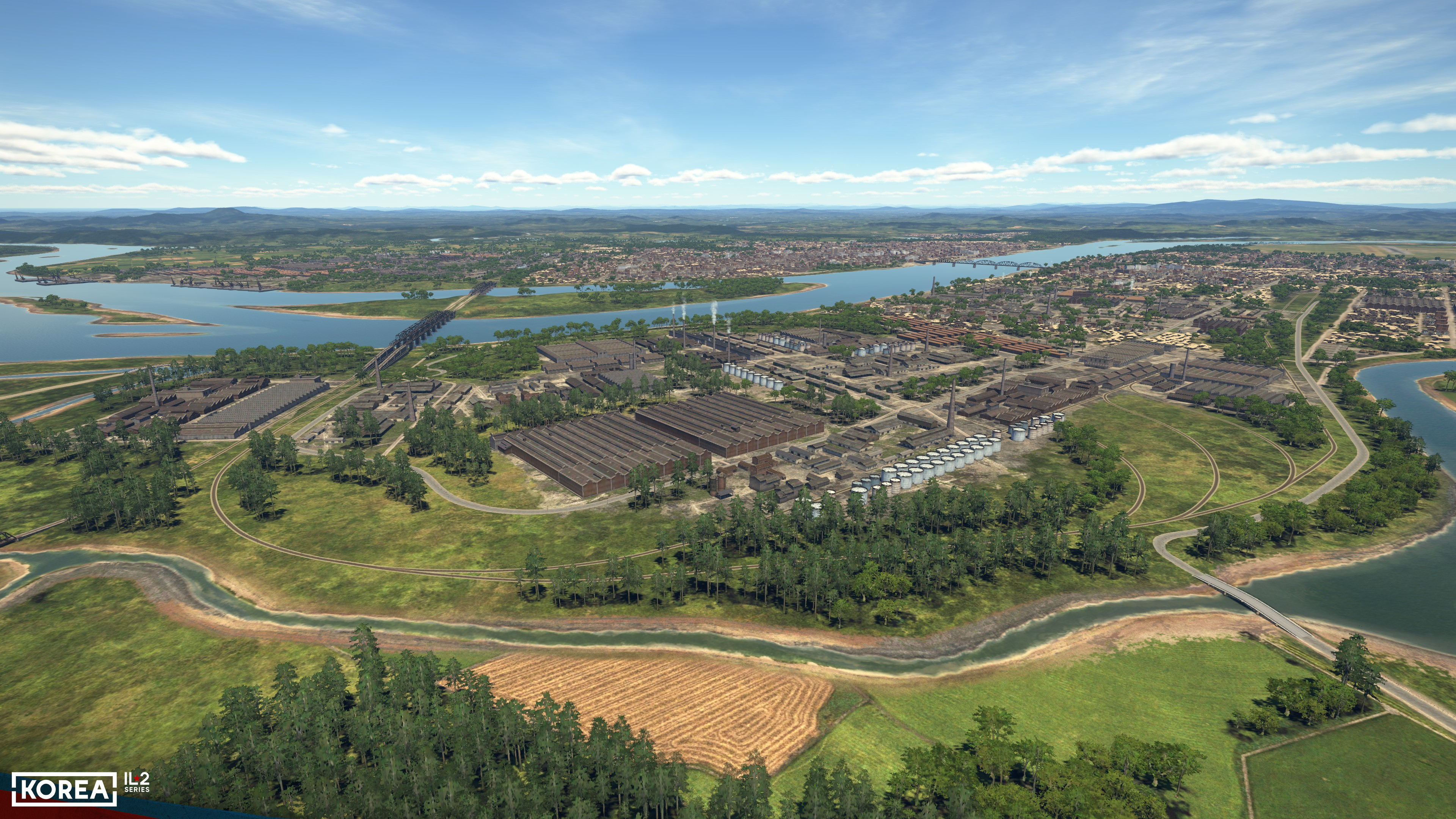
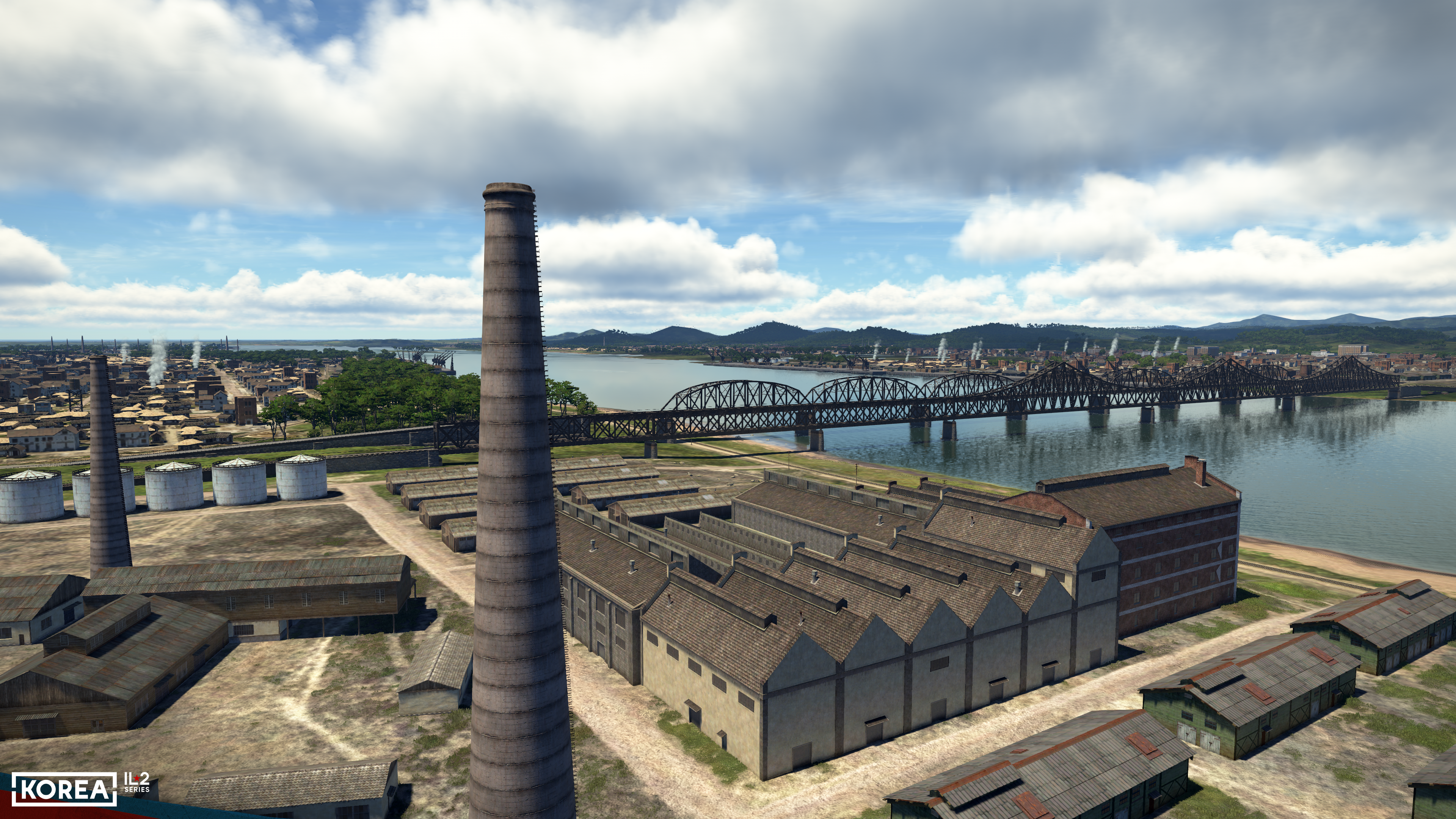
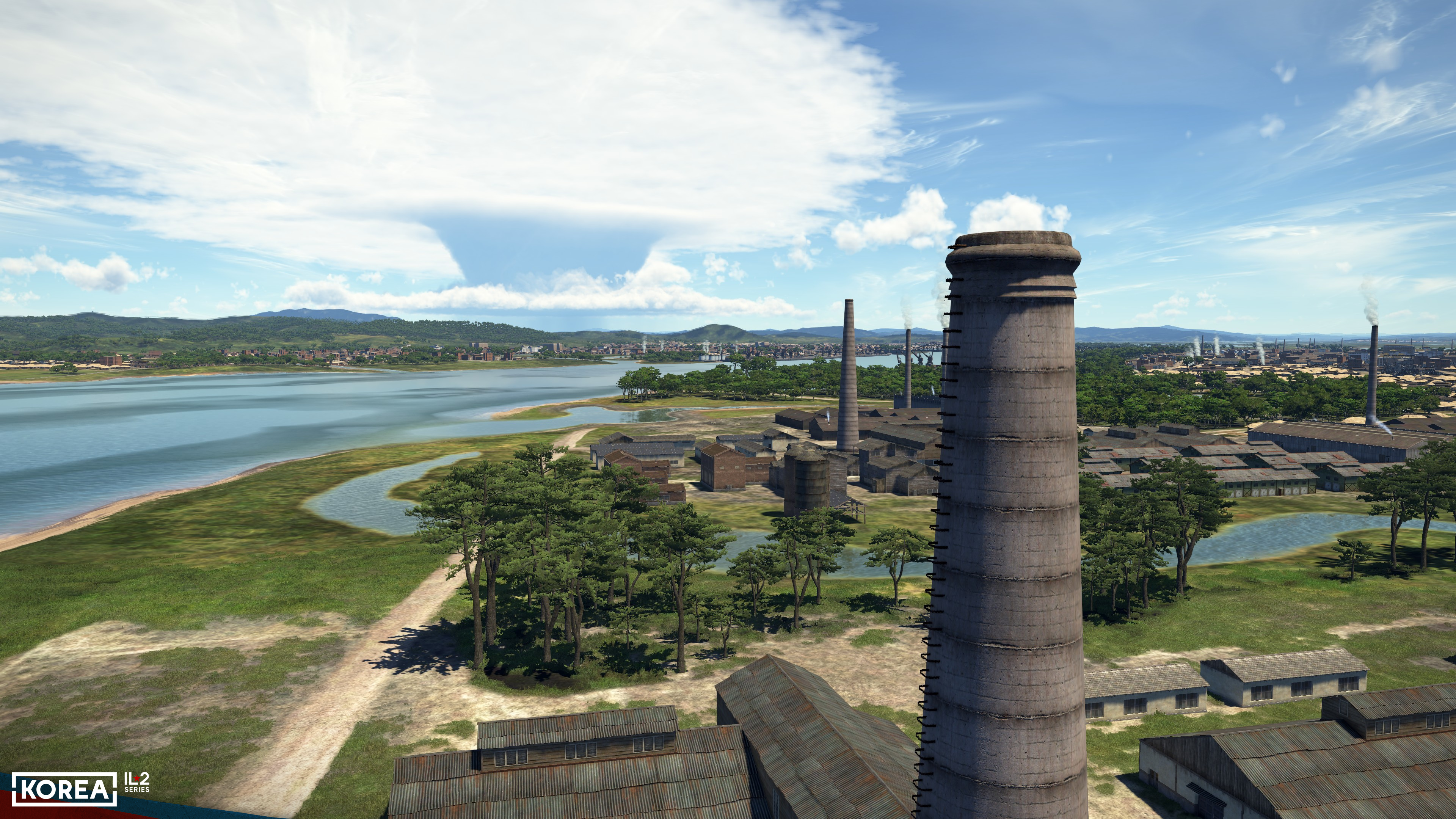
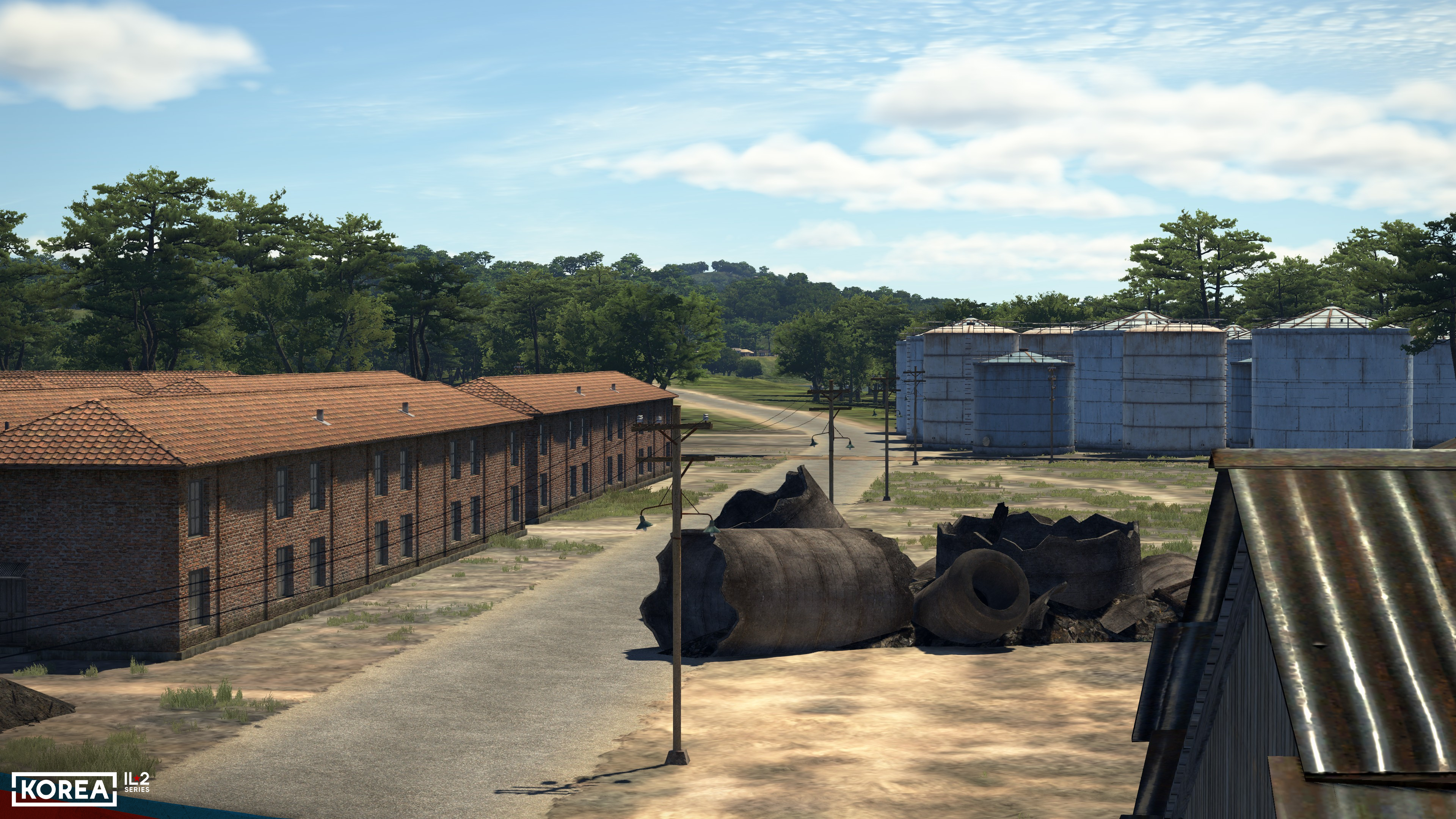
The buildings in industrial zones and factories themselves were designed based on historical counterparts from the Korea region of that era: production facilities ranging from small structures to massive production areas, various types of warehouses, fuel tanks, materials stored in the open, and smokestacks of various sizes and types.
Speaking of smokestacks, dynamic destruction technology has been applied to model their damage, just as it has for bridges and port cranes. Such oversized objects require special attention when implementing combat interactions with them, so we have deemed it appropriate to apply the technology we previously developed for the Tank Crew project here. For bridges, we had to tweak it slightly by adding physics for debris interacting with the water, since without this, their fall wouldn’t look natural.
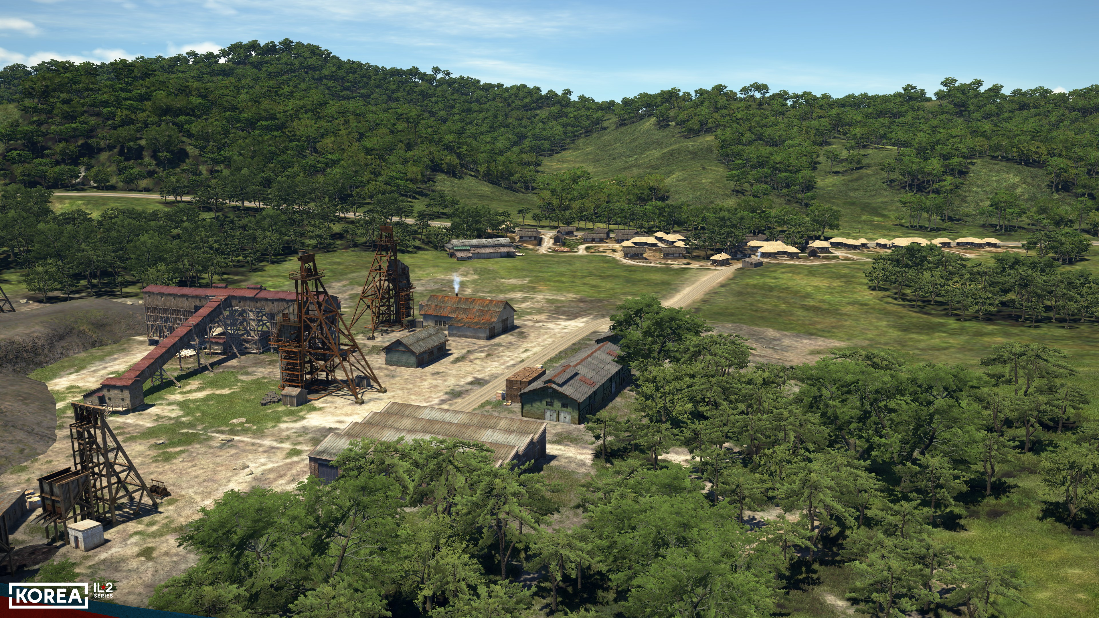
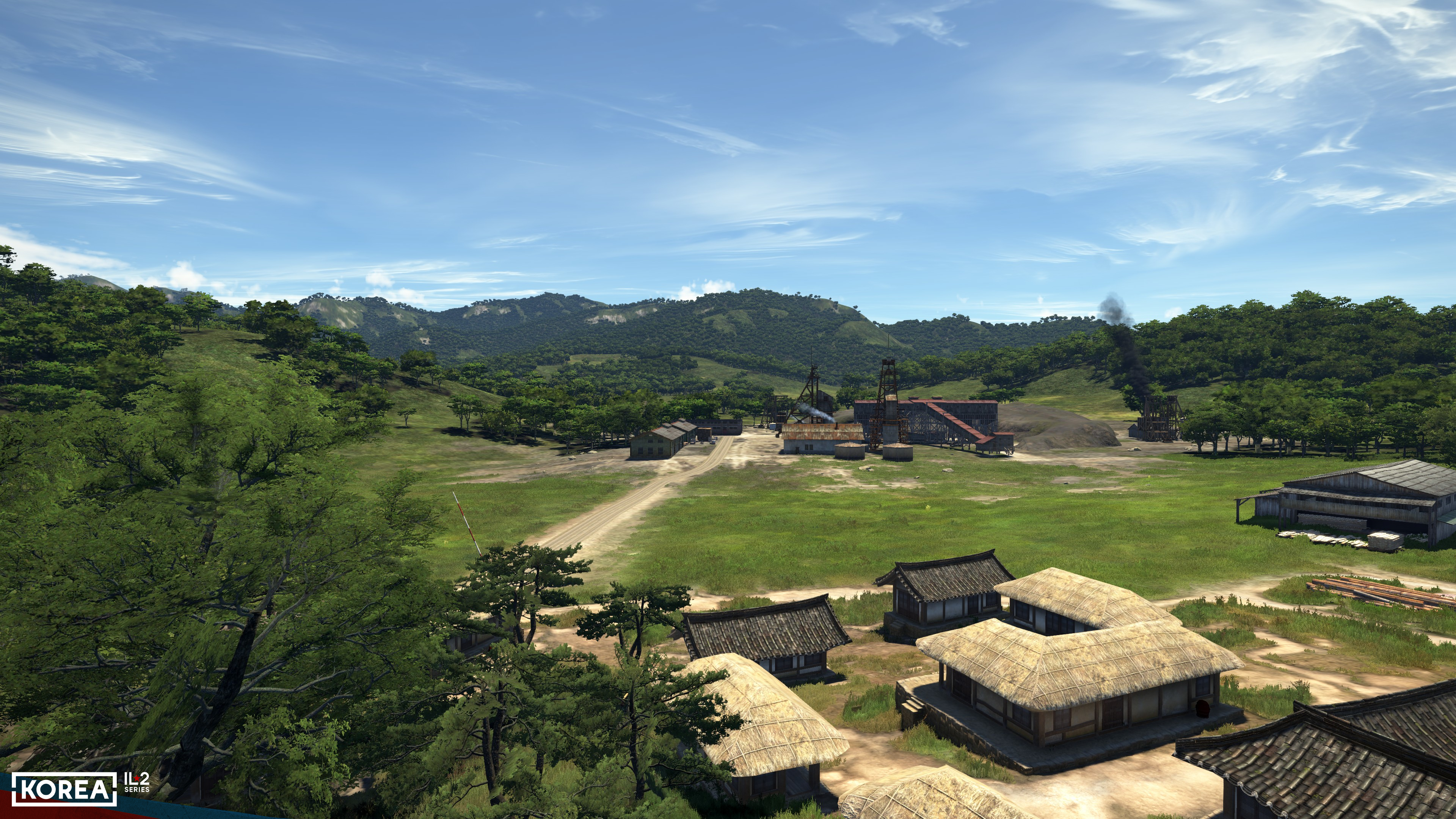
It’s also worth mentioning that this is the first time we’ve paid special attention to the extraction industry. To design locations such as mines, sawmills, and ore processing plants, we have created a set of buildings and objects. Slurry ponds, open-air finished goods warehouses, ore hoists, loading ramps, boiler rooms, barracks, dredges, and much more — all of this has allowed us to recreate these enterprises quite realistically, and you’ll be able to see them in the areas where such industries existed in Korea during the 1950s.
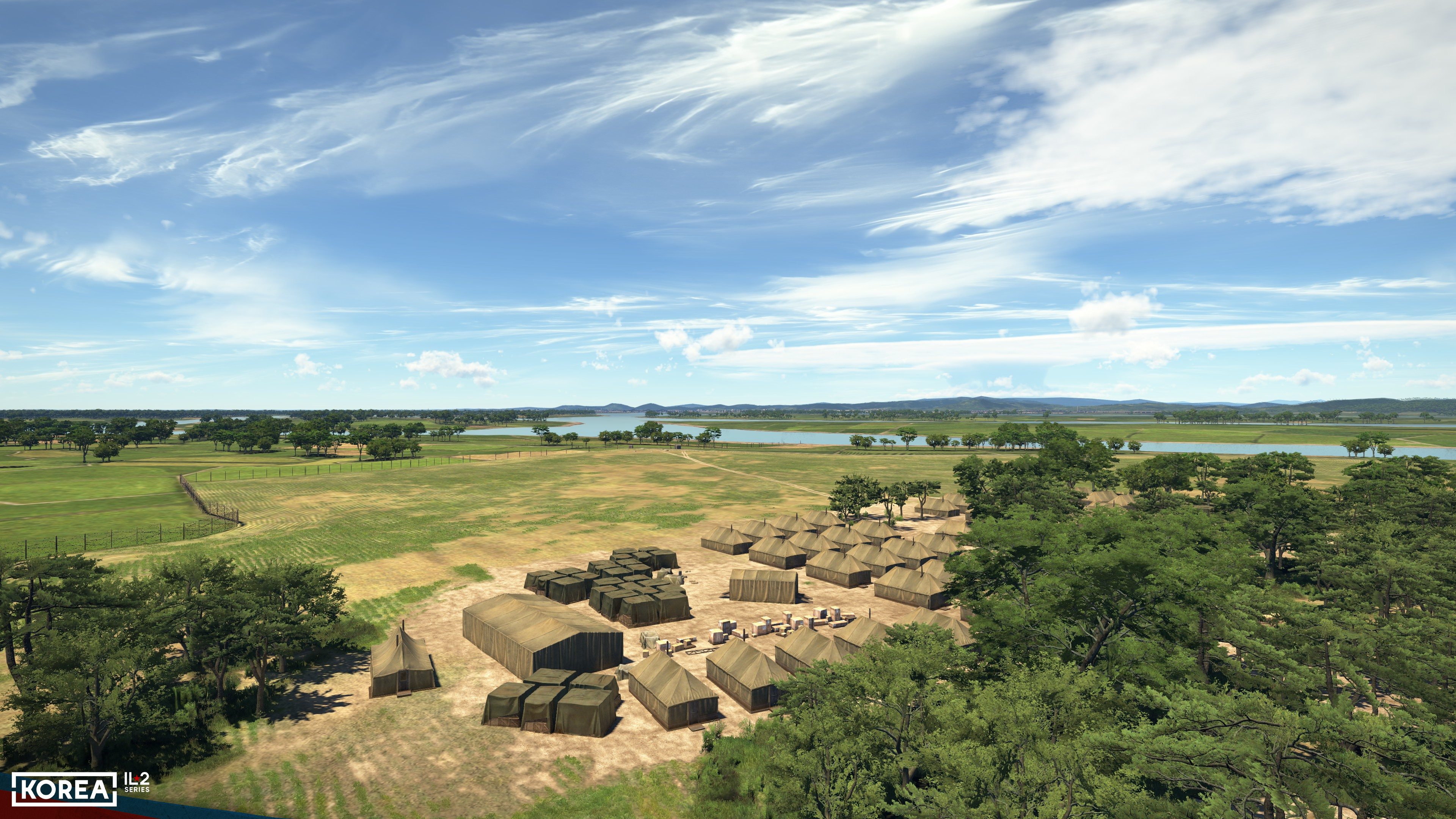
The next type of structures worth mentioning are military camps. This time, we paid special attention to their implementation: the buildings that make up these camps have been recreated based on historical photographs from the Korean War. Tents of various types, headquarters, warehouses, repair areas, fences, checkpoints, barracks, and even showers — all of this has been recreated with great detail based on real photographs from the era. The camps were located both separately and on airfield grounds, significantly contributing to their authentic appearance.
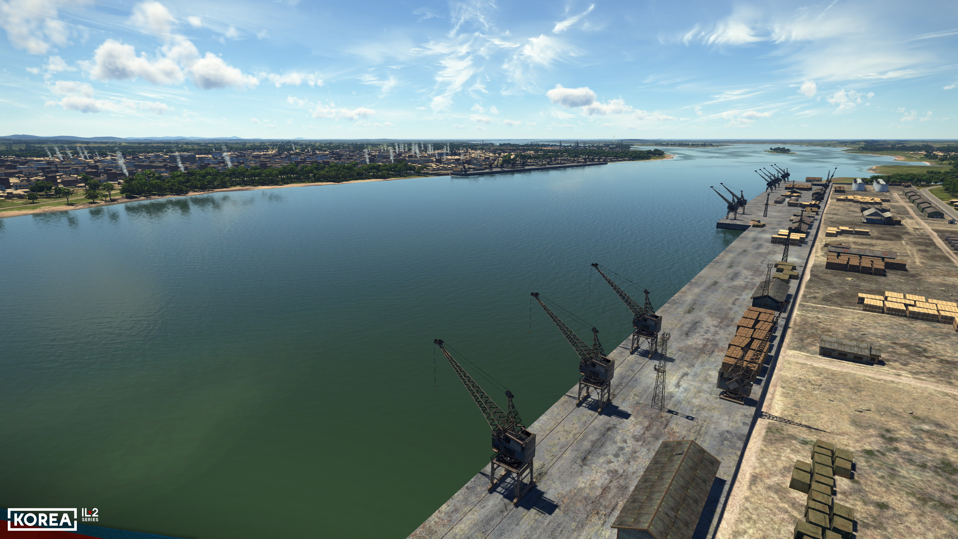
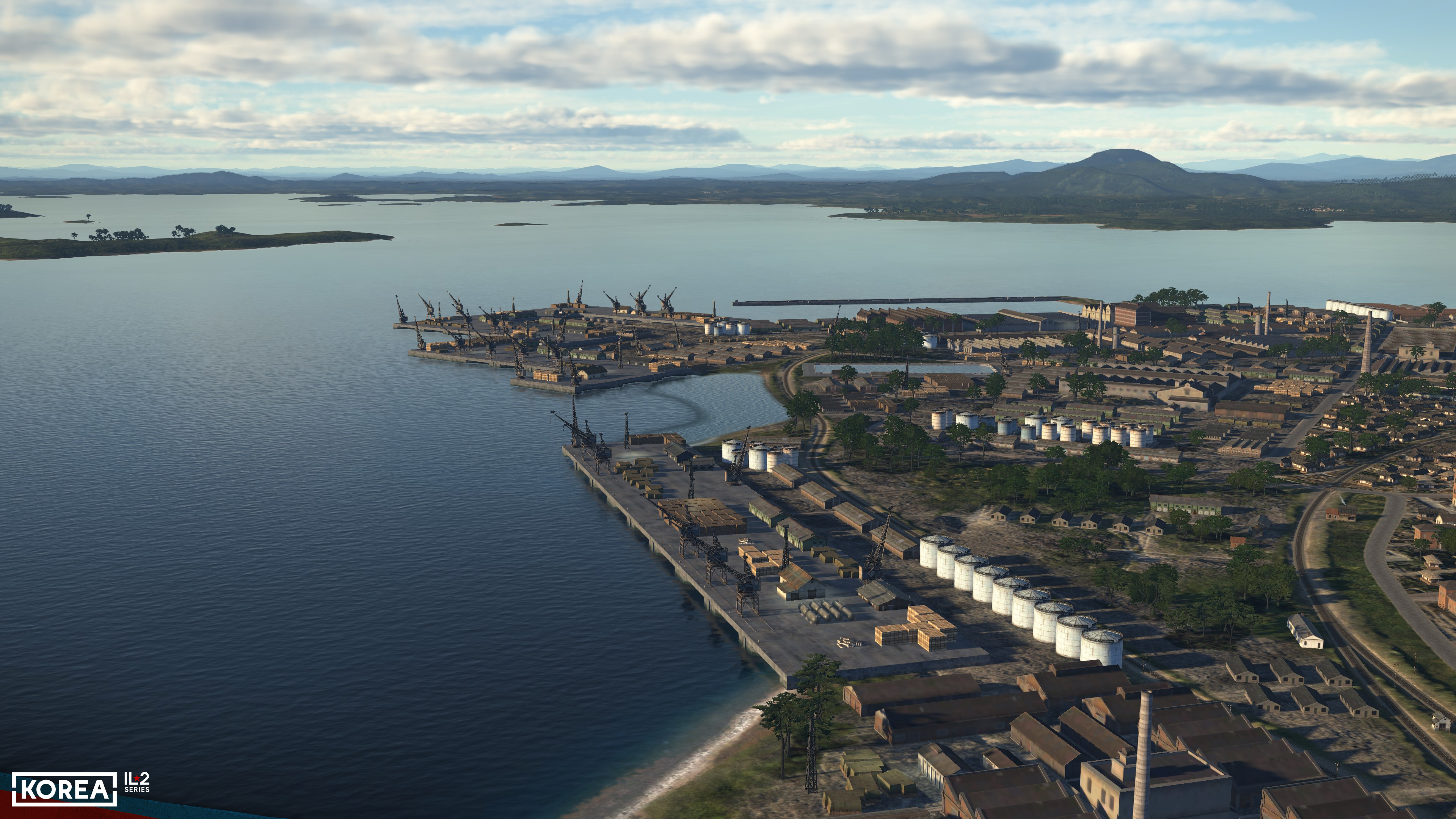
Let’s return to industrial facilities: seaports. A unique set of structures, cranes, stored materials, piers, breakwaters, and quays has also been created for them. A new technology for placing structures on terrain has been developed, allowing a map maker to choose between automatically positioning buildings and objects based on ground elevation and manually adjusting their heights. This technology has made it much more efficient and versatile to use the created structures for designing complex layouts. Waterfronts and piers also required new approaches since their underwater parts are now visible through the water, and reflections in the water have become more detailed.
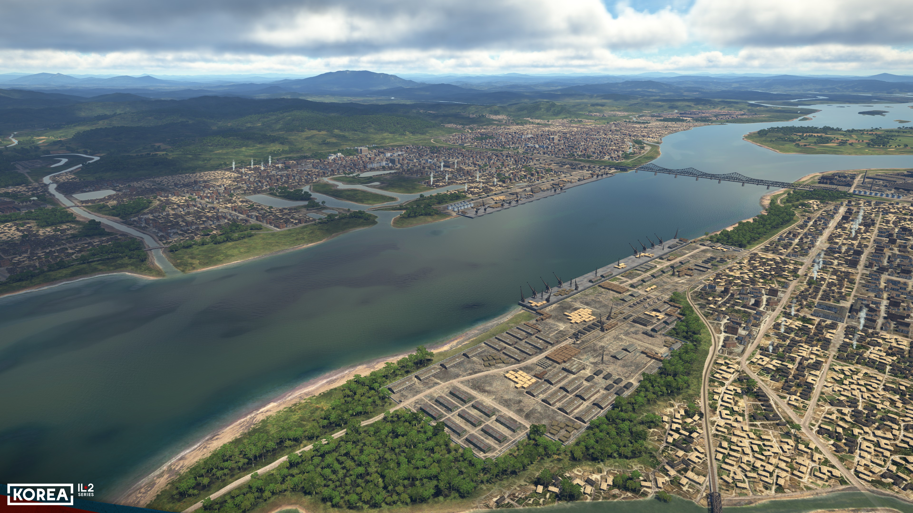
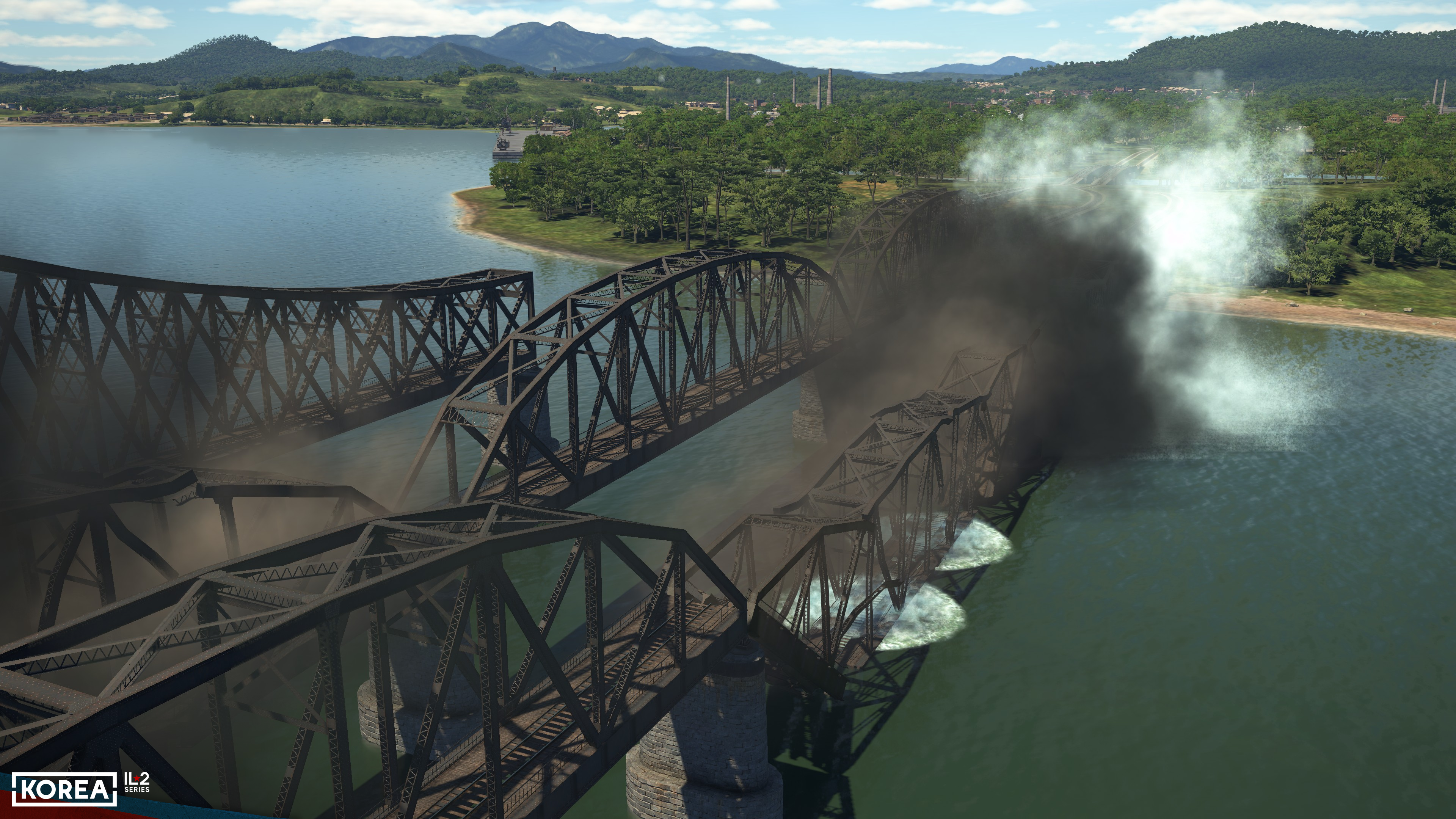
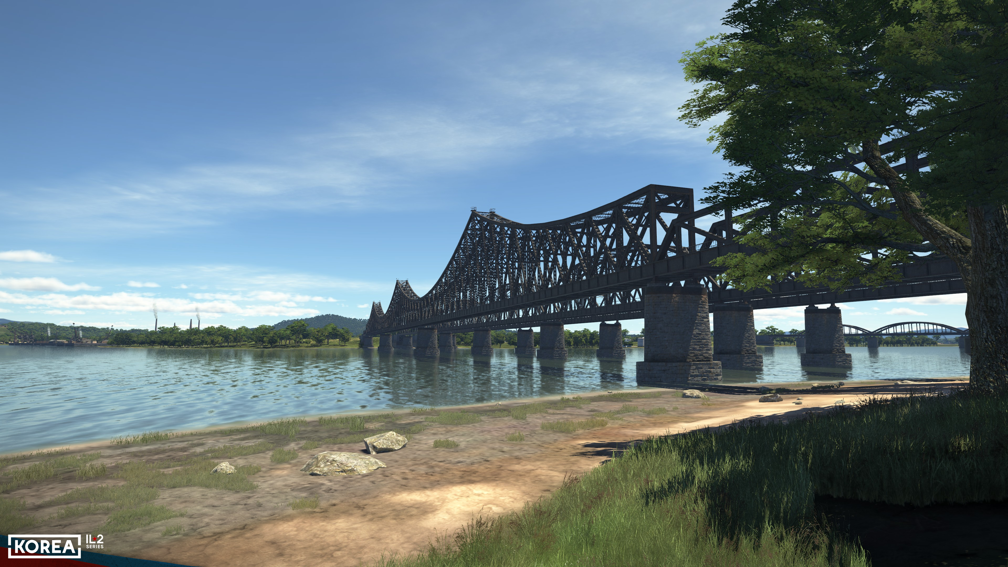
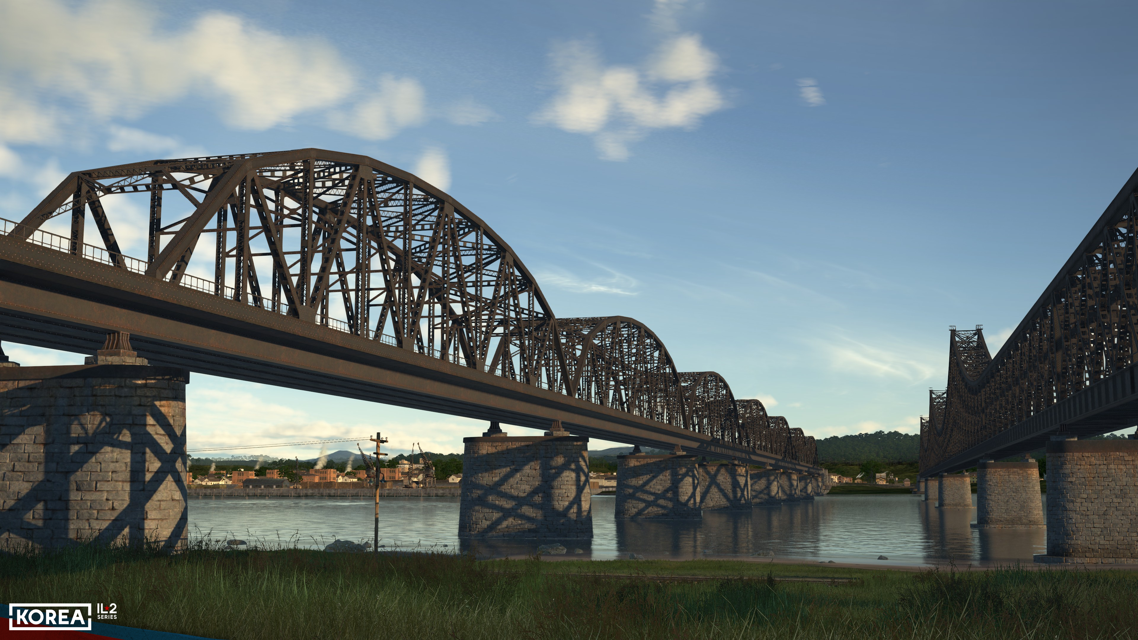
Continuing with the aquatic theme, bridges deserve special mention. To capture the full variety of bridges in Korea, a special construction kit has been developed, comprising 44 elements: road, railway, beam, truss, cantilever, temporary wooden, and transition sections. Large bridges have been built using this kit. Additionally, 22 unitary models of medium- and small-sized road and railway bridges have been developed, along with two types of pontoon bridge fleets — Soviet and American. As noted above, almost all bridges feature a dynamic destruction model, especially the pontoon bridges. If you destroy a section of a pontoon bridge, you’ll see the boats it was supporting gradually take on water and sink.
In conclusion, we should mention a type of man-made structure that is new to us: dams. The Korean Peninsula is largely mountainous terrain bordering the ocean and therefore receives abundant rainfall, which has led to an exceptional abundance of aquatic resources. Countless rivers flowing down from the mountains created enormous opportunities for hydropower development in the region, and by the 1950s, this development had indeed taken place in Korea. On our map, you will see the main large-scale hydroelectric facilities — a total of 22 sites, including, of course, the Sup’ung Hydroelectric Power Plant — the target of large-scale strikes by Western forces.
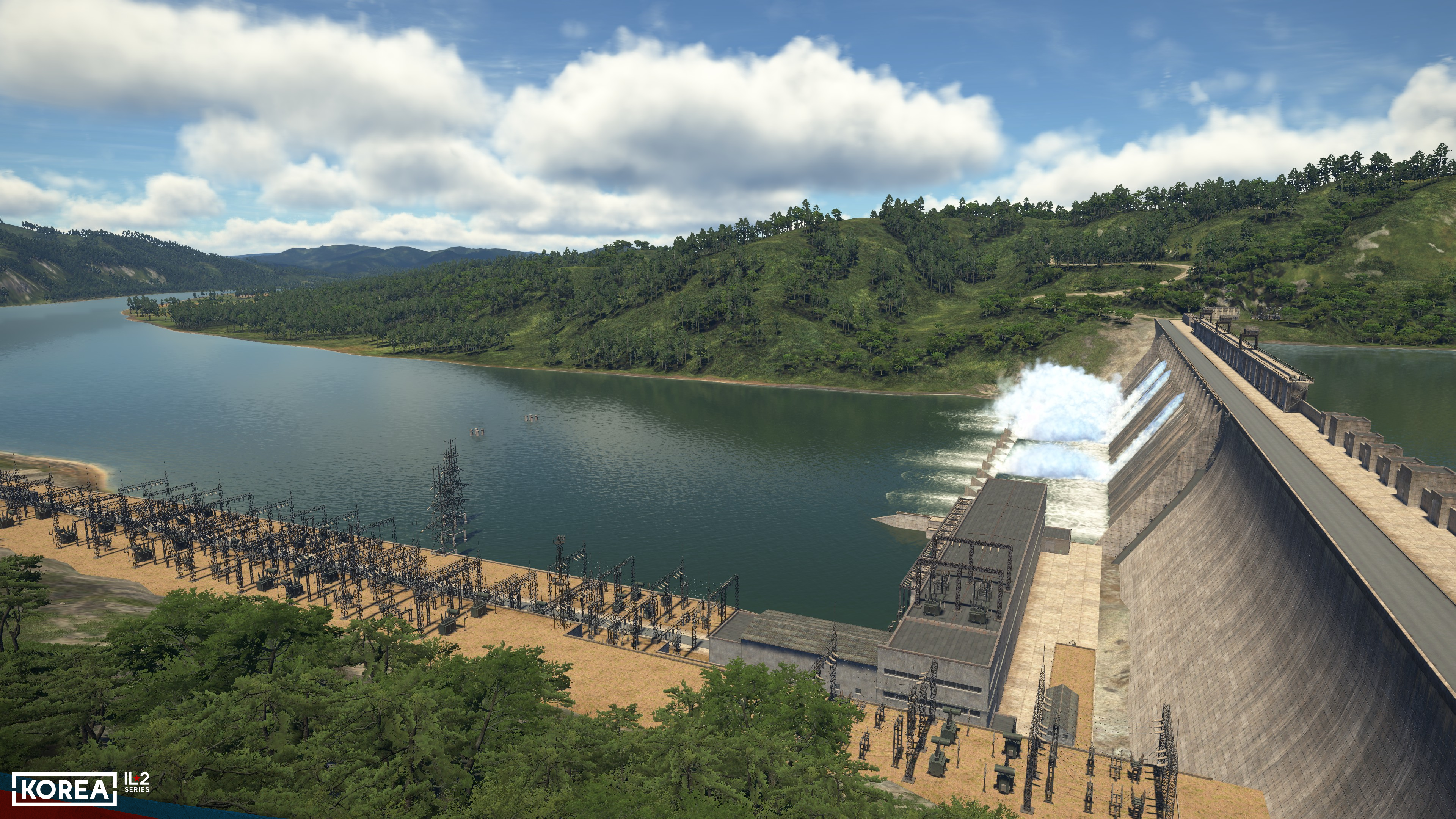
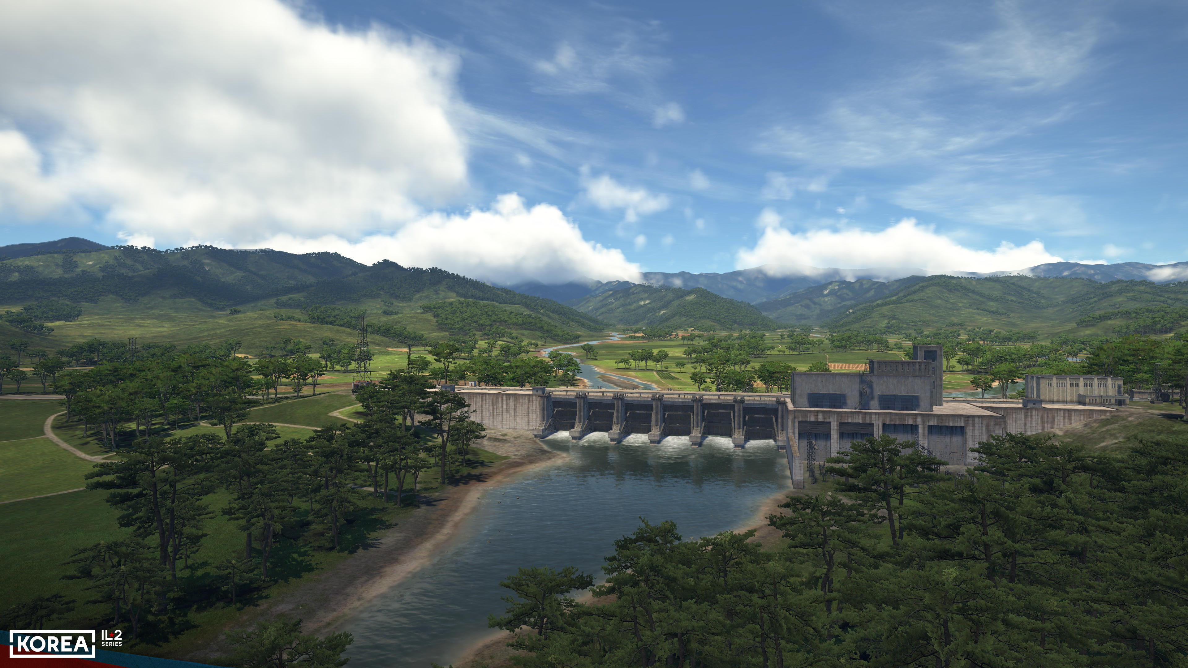
Since dams are key features on the map, several technologies have been developed specifically for them. First, the system for rendering reflections in water has been significantly refined, allowing them to be displayed correctly even when water levels differ significantly over short distances. The fourfold increase in the terrain mesh density has been a major help in rendering the dams.
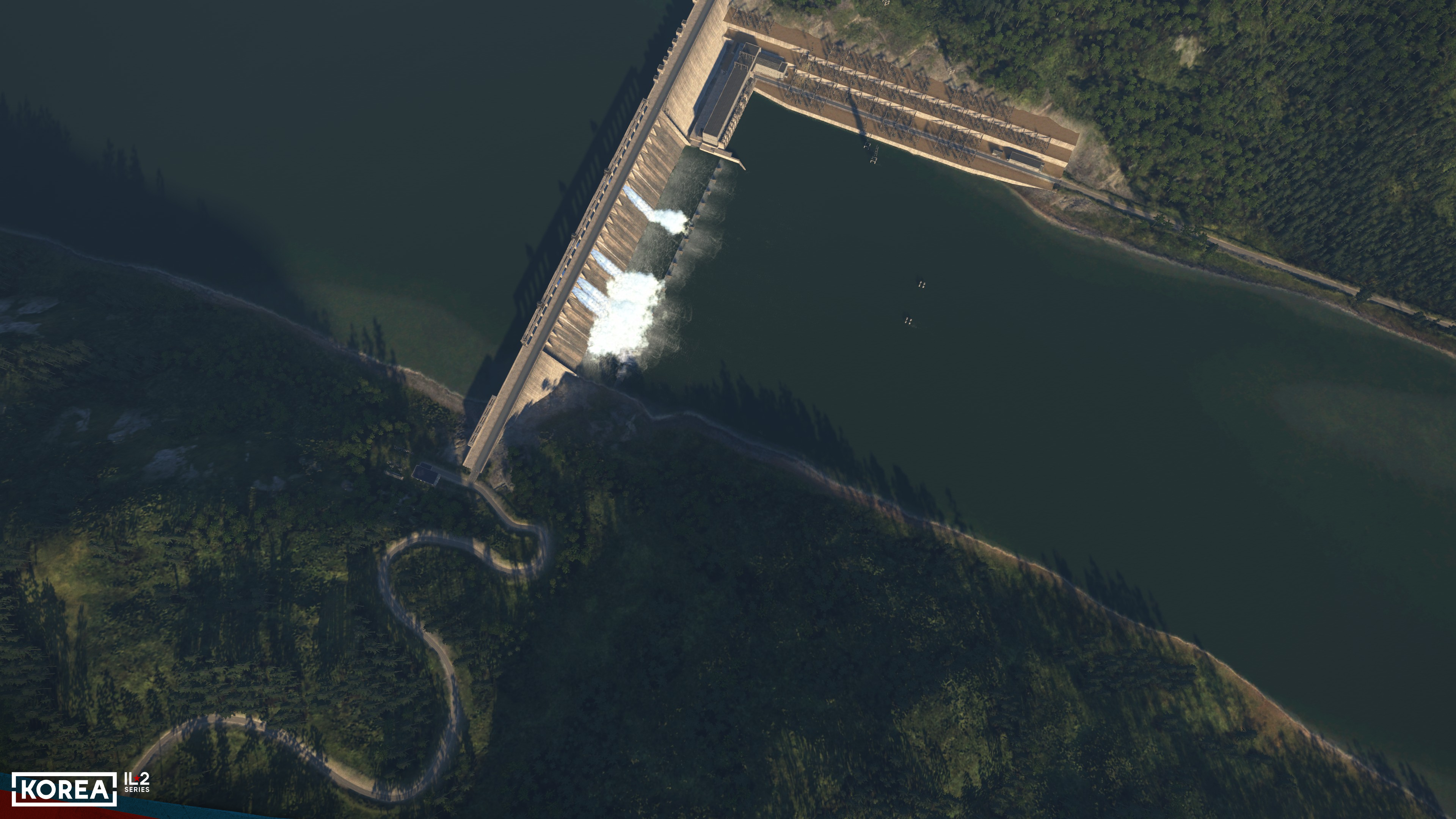
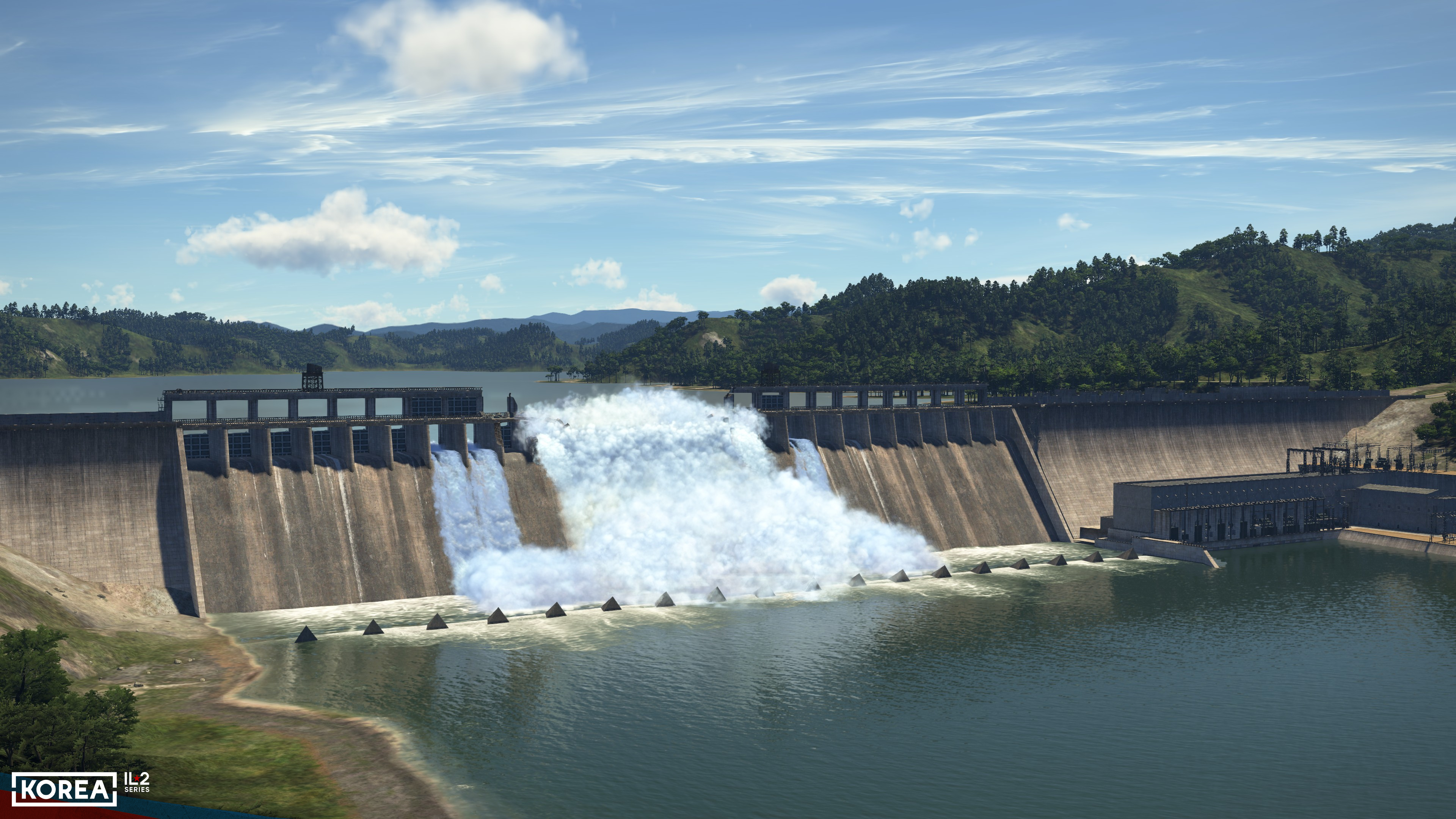
The new technology has allowed us to implement both the flowing water of mountain rapids and the movement of water beneath the dams' spillways. Meanwhile, the new system of graphical effects and their integration with structures has enabled us to create a remarkable visualization of water flowing through open dam spillways and through significant damage openings in the dam itself.