


Dev Blog #64
Hello, everyone!
Today we're going to talk about cities.
We first showed a prototype visualization of a city in Korea back in the 7th issue of our dev blog. At that time, it was just a prototype — many aspects were far from final. Now, a year and a half later, we are ready to show what the cities of Korea will look like at the time of release. Yes, the development of a new city-building technology that uses the polygonal outlines of neighborhoods, with buildings that "grow" automatically, was completed back then. Still, the artistic approach has been refined over time in search of the best visual solution.
The result of this work was a new set of landscape textures, including textures for urban, rural, and industrial areas. This is always a difficult task, since the final appearance of the landscape, and even more so the urban landscape, is the result of the closely intertwined interaction of elements such as the lighting system, the shadow system, the material system, the configuration of the basic properties of surfaces in the building model, texture solutions in the landscape, building texturing, atmospheric haze, optimization requirements, historical documents and compliance with them, night lighting, and much more.
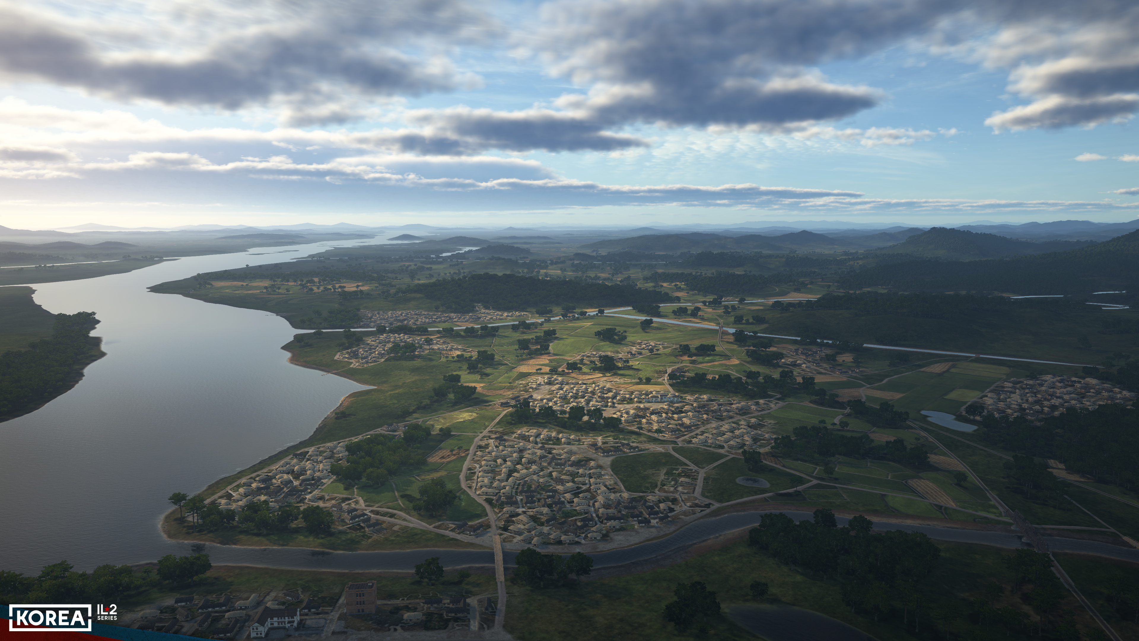
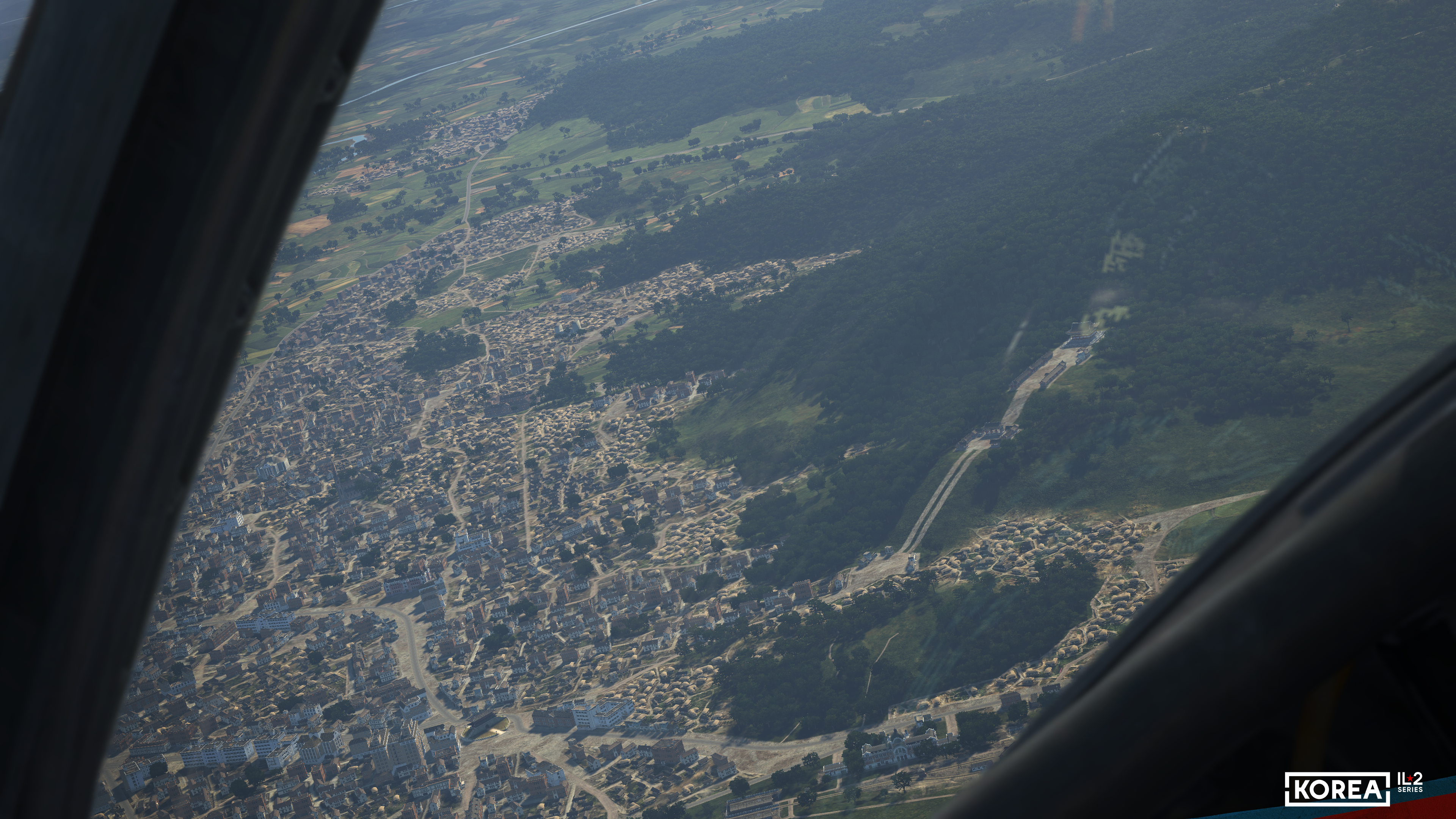
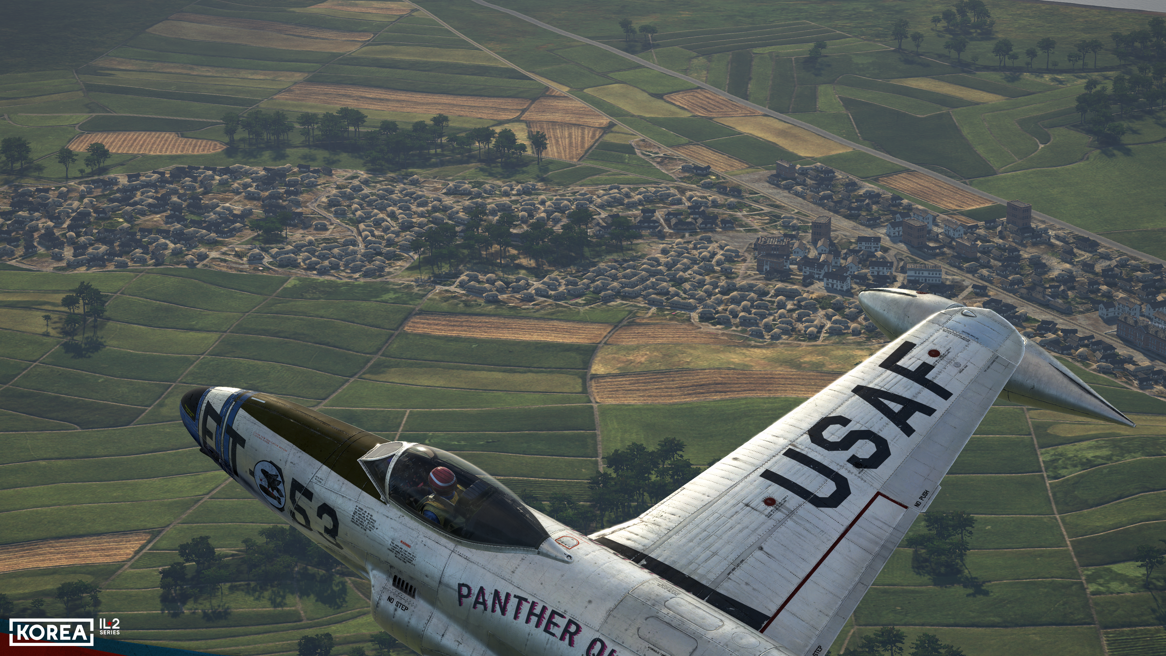
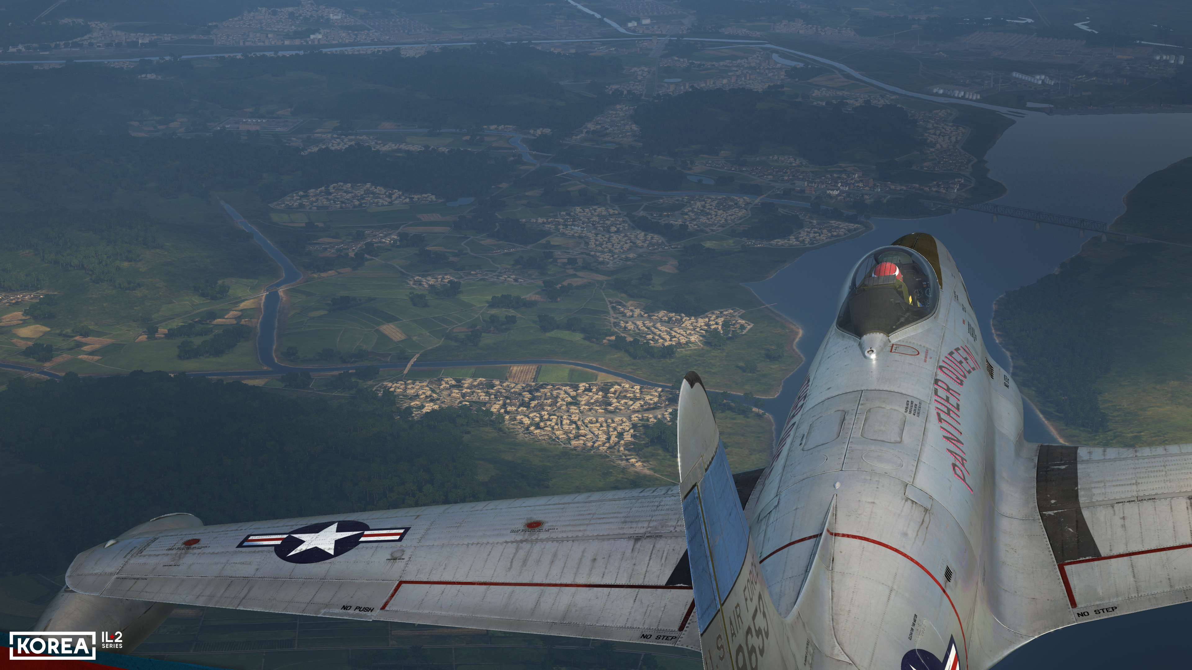
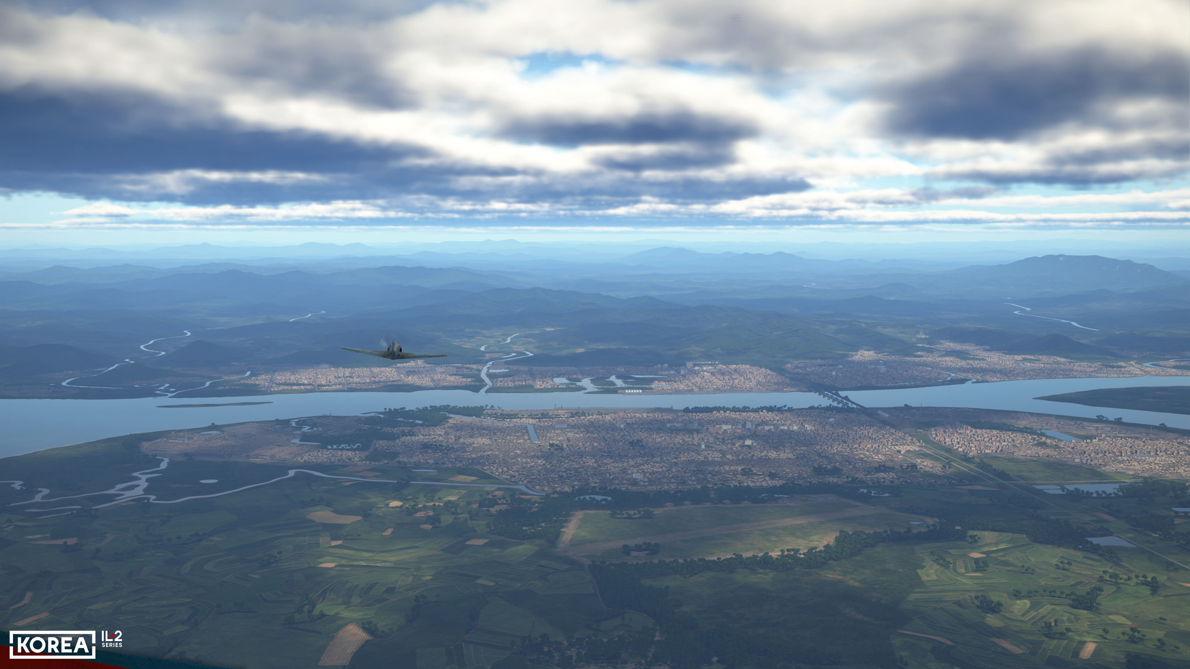
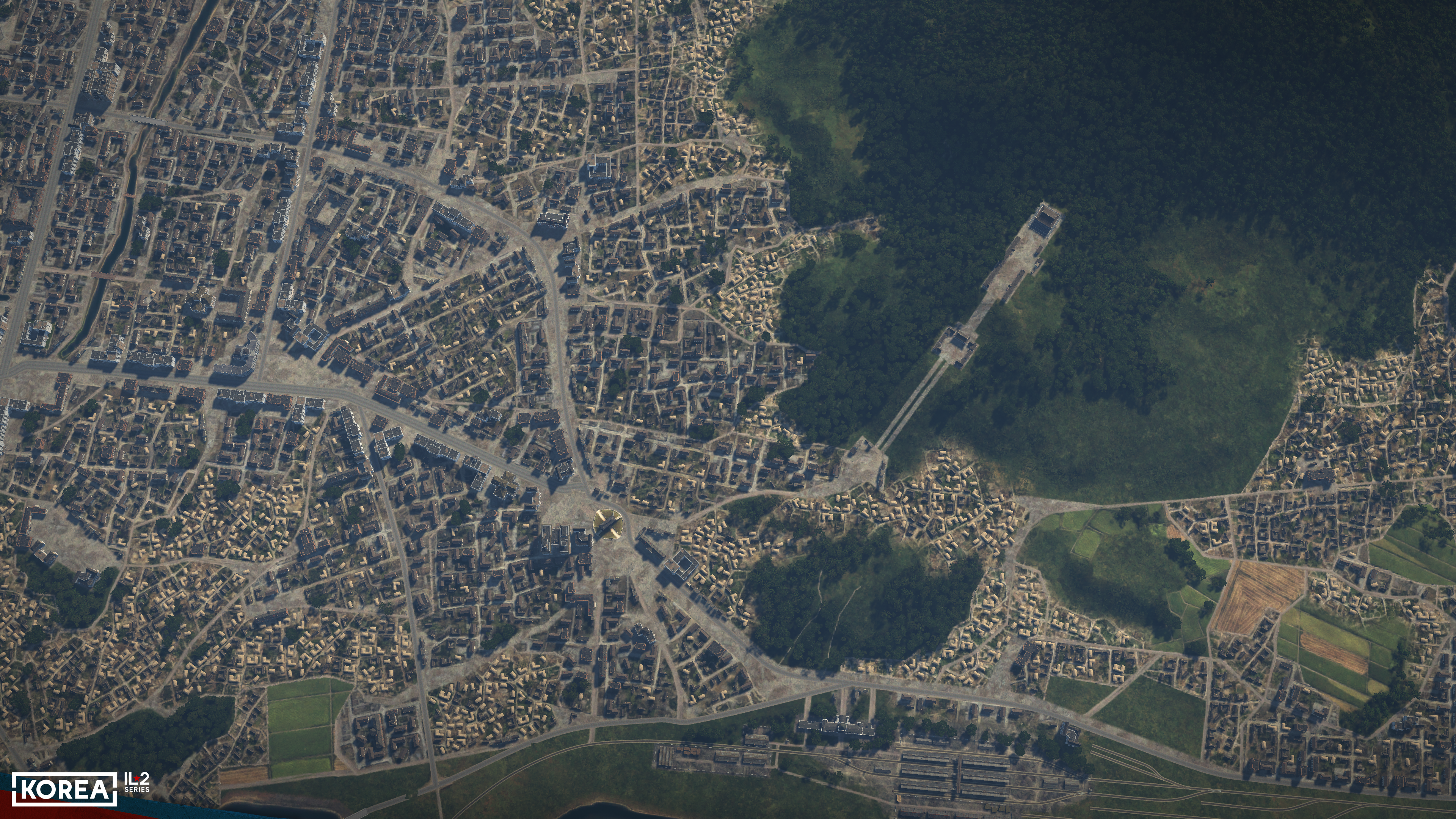
As a result, after coordinating all elements of the urban landscape image, we arrived at the result you see in these screenshots. We think it turned out really great!
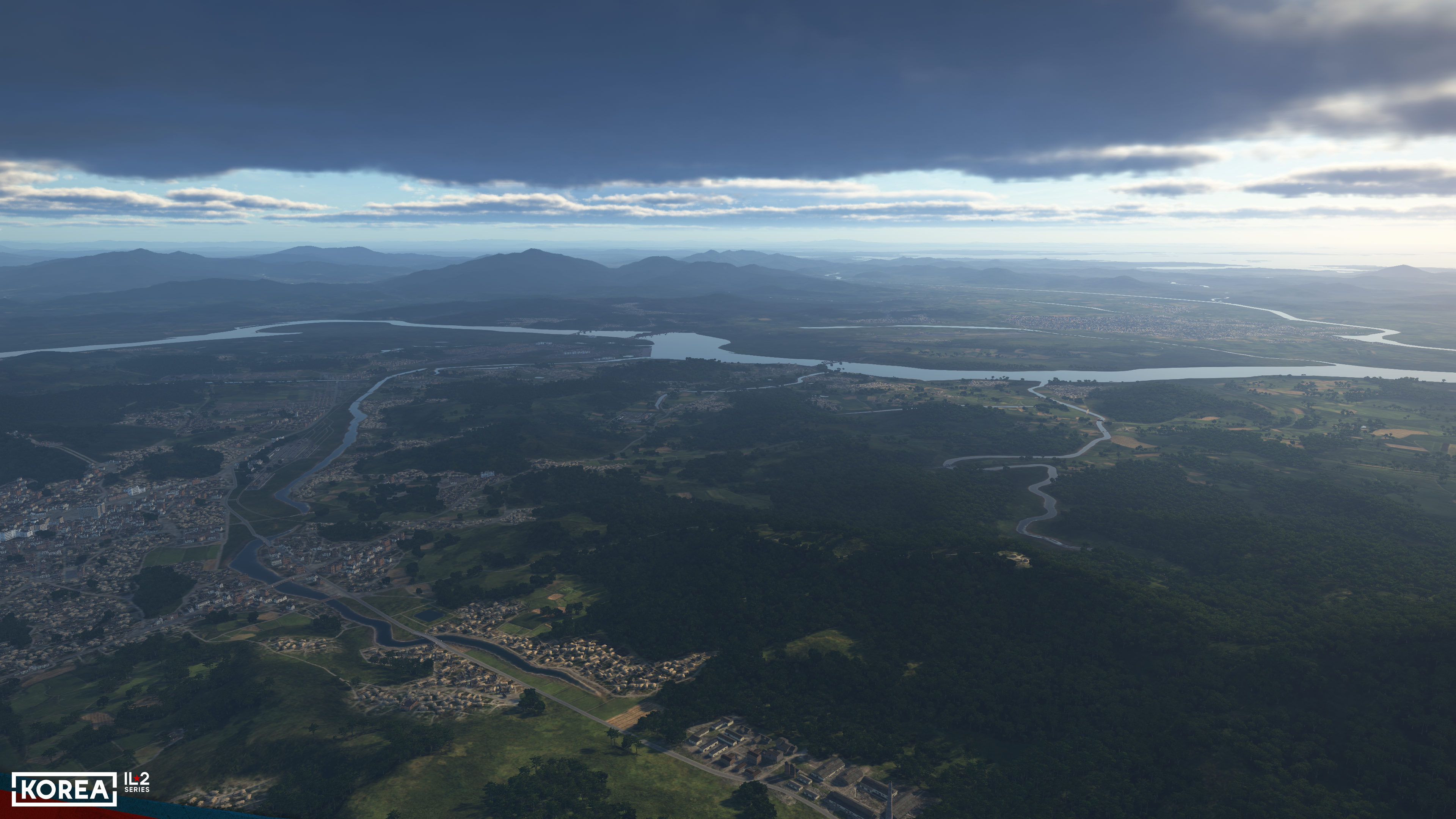
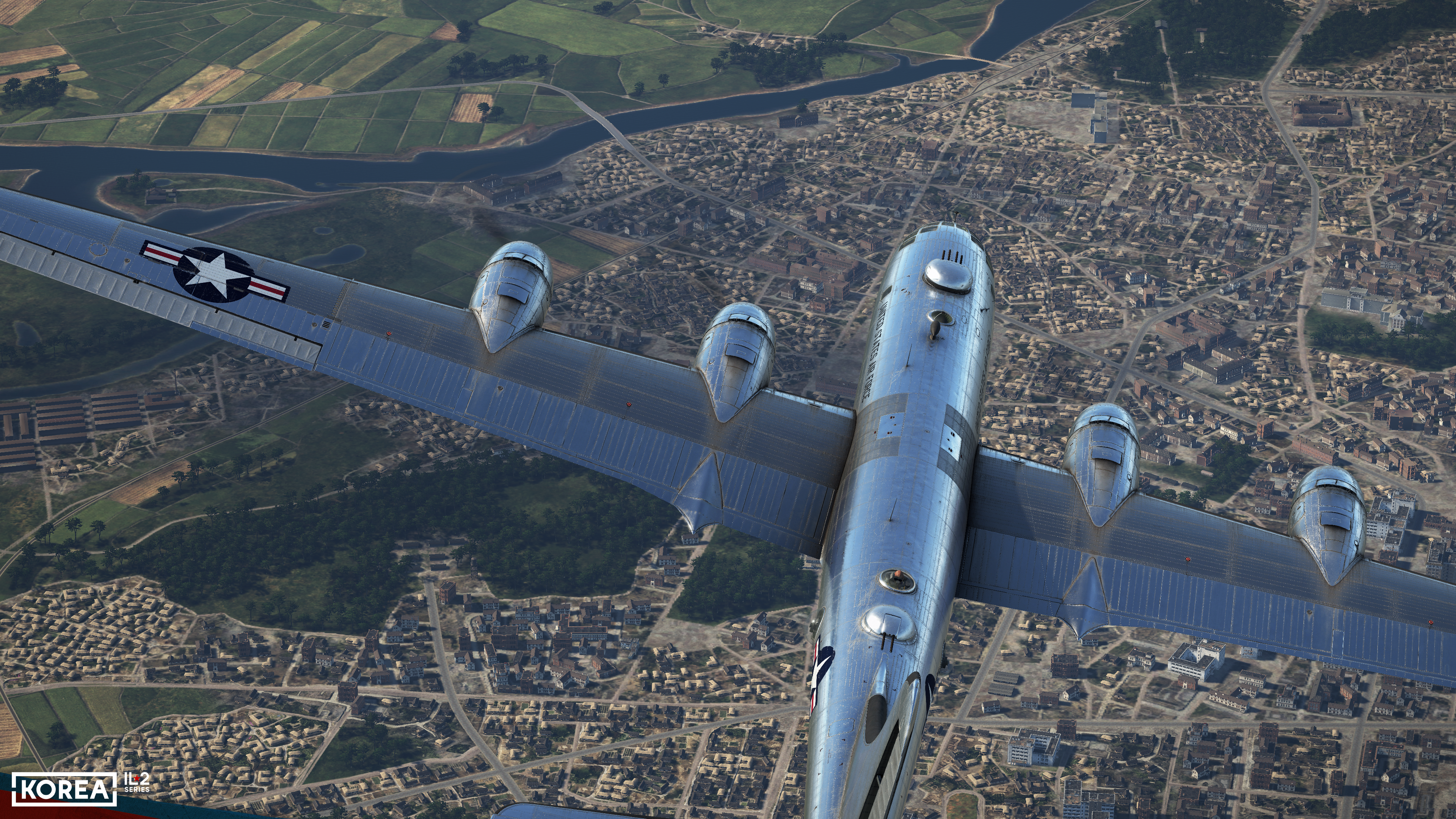
The view of the city in "Korea" is realistic and believable, corresponds to the historical architecture of the 1950s, and reproduces the original well in terms of layout. It has a whole new level of detail at short and medium distances, unattainable in our previous projects.
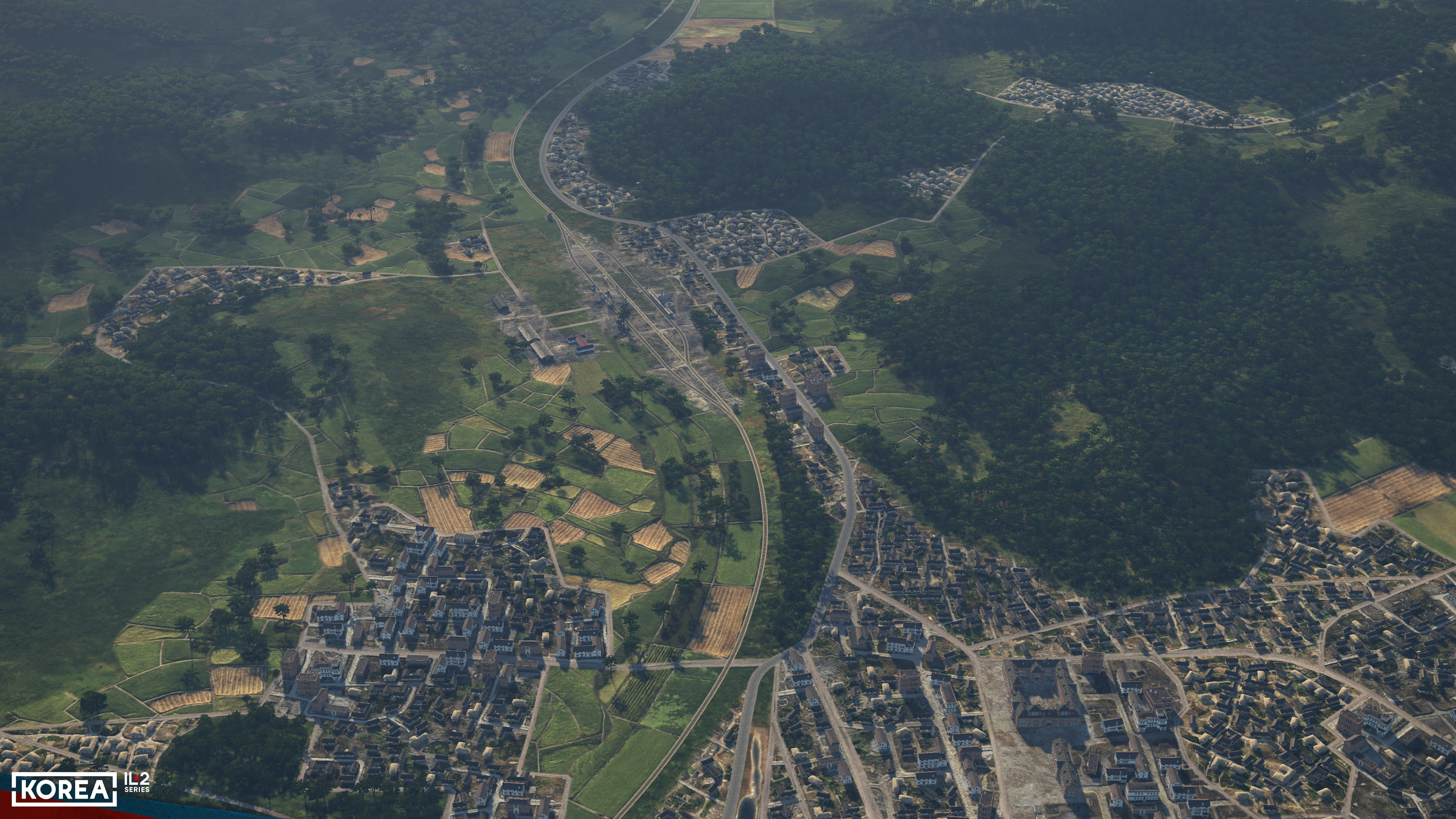
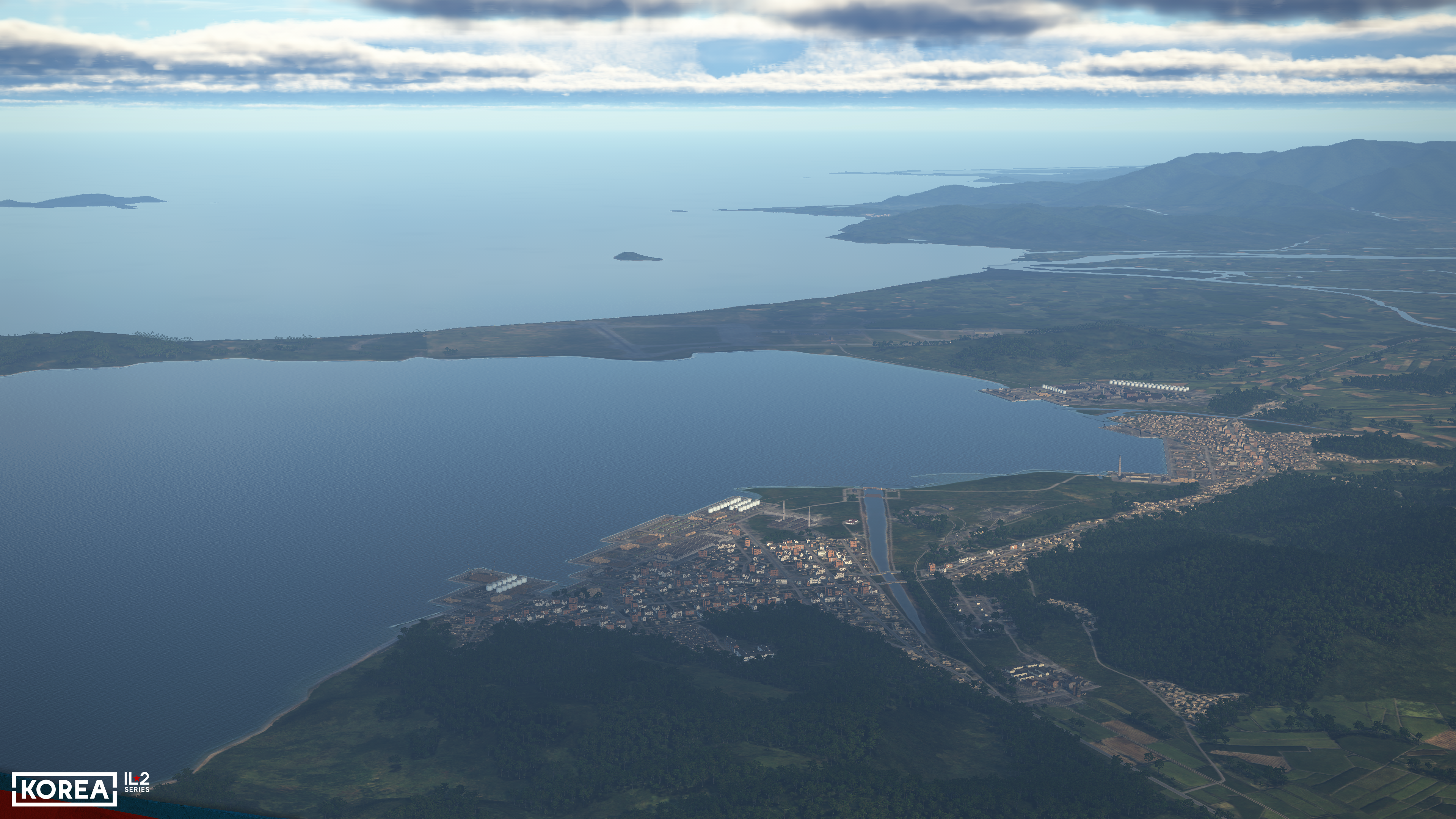
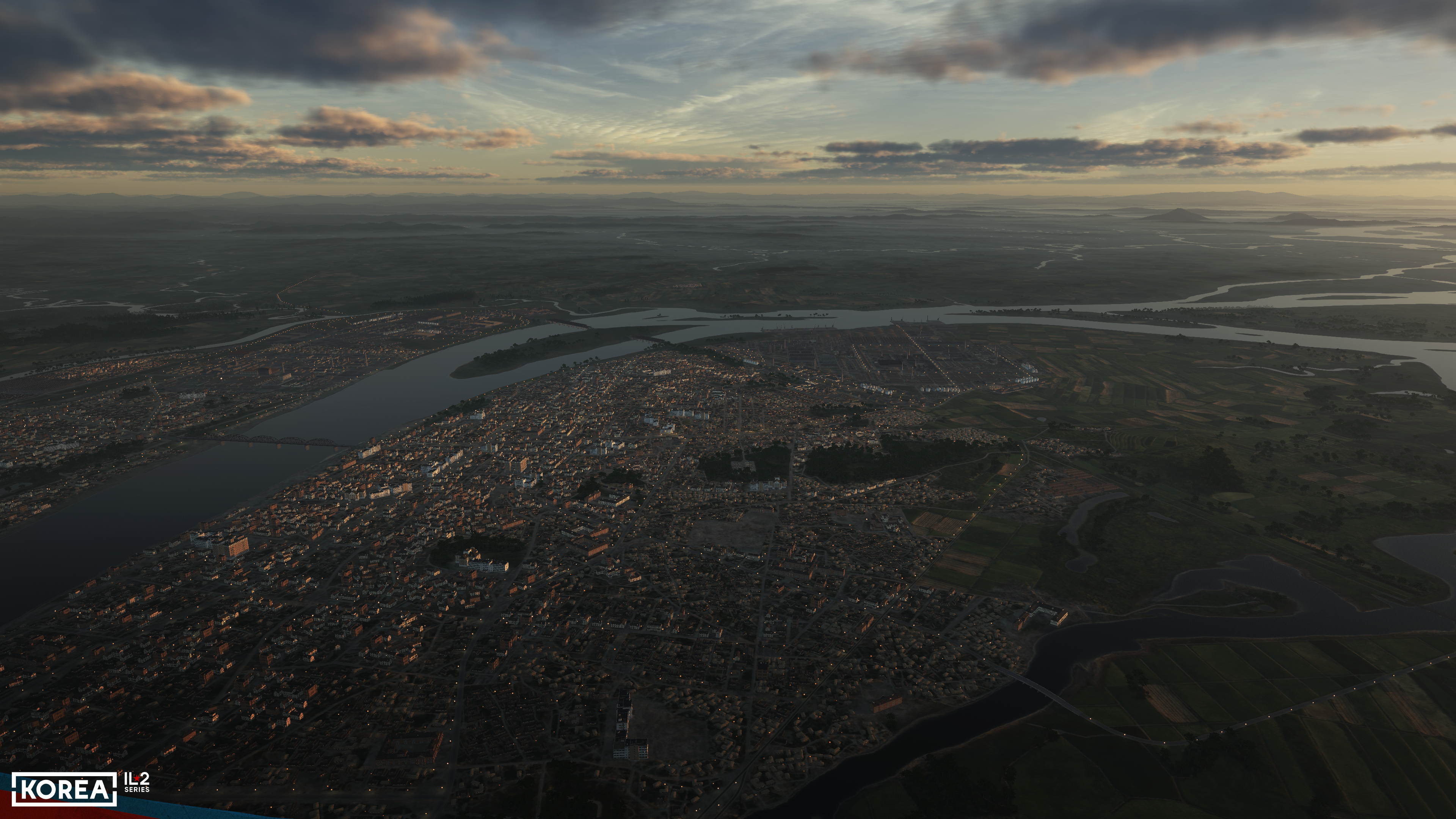
The layout of the cities has become much more naturalistic. When viewed from above or horizontally, you can see the city center, the area of medium-rise urban development, and the private sector, which at that time in Korea made up most of the area of even the largest cities. Settlements, large and small, are much more naturally integrated into the surrounding landscape and textures than was even the case in our "Normandy." Small paths and trails are visible, as are traces of machinery and human movement.
All this is the result of long, painstaking work with documents, historical data, and manual labor to reproduce each city. We would very much like to perform photogrammetry of the environment, because this method allows artists to spend less time and cover large areas. Still, given that we are implementing cities in their historical form, there is simply no way to do so. We have tried to make the modeled world, and in particular the cities, as realistic as possible.
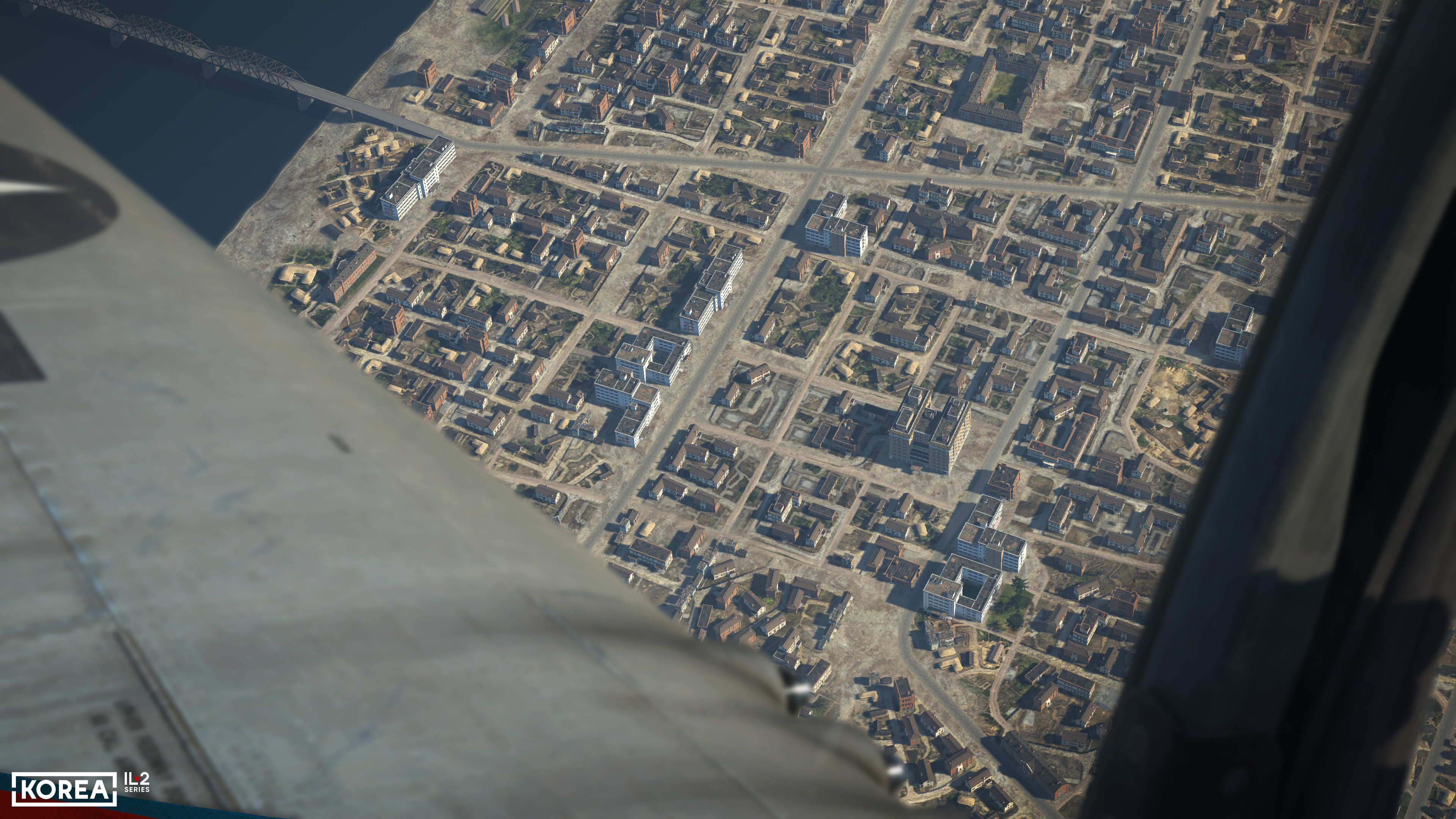
In addition to the details of the cities, the number of them is impressive as well. New technologies for creating map scenes have enabled the creation of 800 settlements in a short time, 26 of which are large cities. These cities have 12 seaports and are connected by an extensive road network totaling 11,000 kilometers (!).
To reproduce the appearance of Korean cities, about 100 models of various buildings have been created, many of which have additional variations. The visual quality of all this is on a completely new level compared to previous projects.
Generally speaking, a map in a flight simulator can be refined "forever." There is always something that you want to improve, even though much of it is already good. And we will continue to work on this both in the time remaining before the release and after it.
Furthermore, as we approach the release of "Korea," we plan to reveal a few more topics related to the new landscape and map.
We have also launched the game’s Steam page — feel free to add "Korea. IL2 Series" to your wishlist.
The closer we get to the release of Korea, the more we will be able to show you the combat aspects of our simulator. Subscribe to our channels: YouTube, Facebook, Reddit, X, and Discord. Stay in touch!
The closer we get to the release of Korea, the more we will be able to show you the combat aspects of our simulator. Subscribe to our channels: YouTube, Facebook, Reddit, X, and Discord. Stay in touch!